Imagine walking through a place where an entire city once stood—markets were full of people, temples were busy, families lived in their homes, and travelers filled the roads. Then, for one reason or another, the city was abandoned and eventually faded from history.
Some cities were buried by volcanic eruptions. Others were swallowed by deserts, covered by forests, destroyed by wars, or simply abandoned as people moved somewhere else.
What makes these places so fascinating is that they aren’t just legends or fictional cities. They actually existed. Centuries or even thousands of years later, archaeologists discovered their remains and uncovered the stories they left behind.
From the famous ruins of Pompeii to the mysterious ancient city of Mohenjo-daro, here are 15 lost cities that really existed—and what happened to them.
1. Pompeii
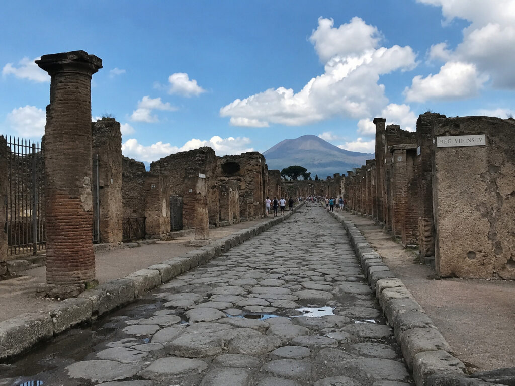
Pompeii Archaeological Park is one of the most remarkable archaeological sites in the world. It was once an ancient Roman city that was buried by the catastrophic eruption of Mount Vesuvius in AD 79.
What makes Pompeii so fascinating isn’t just that a volcano destroyed it. The eruption buried and preserved much of the city, including houses, streets, shops, temples, paintings, restaurants, public baths, graffiti, gardens, tools, food, and even the impressions left by people who died there.
UNESCO considers Pompeii an exceptionally complete example of an ancient Roman city, giving us a rare look at what everyday life was like nearly 2,000 years ago.
The eruption of Mount Vesuvius
In AD 79, Mount Vesuvius suddenly erupted, sending huge amounts of volcanic material into the sky. Ash and pumice began falling over Pompeii, covering streets, homes, and buildings.
Later, extremely hot clouds of ash and volcanic gases, known as pyroclastic surges and flows, swept through the area. Thousands of people died across the affected region, although the exact number of victims at Pompeii is still unknown.
The city was eventually buried under several meters of volcanic deposits, hiding it for centuries.
Why were bodies preserved?
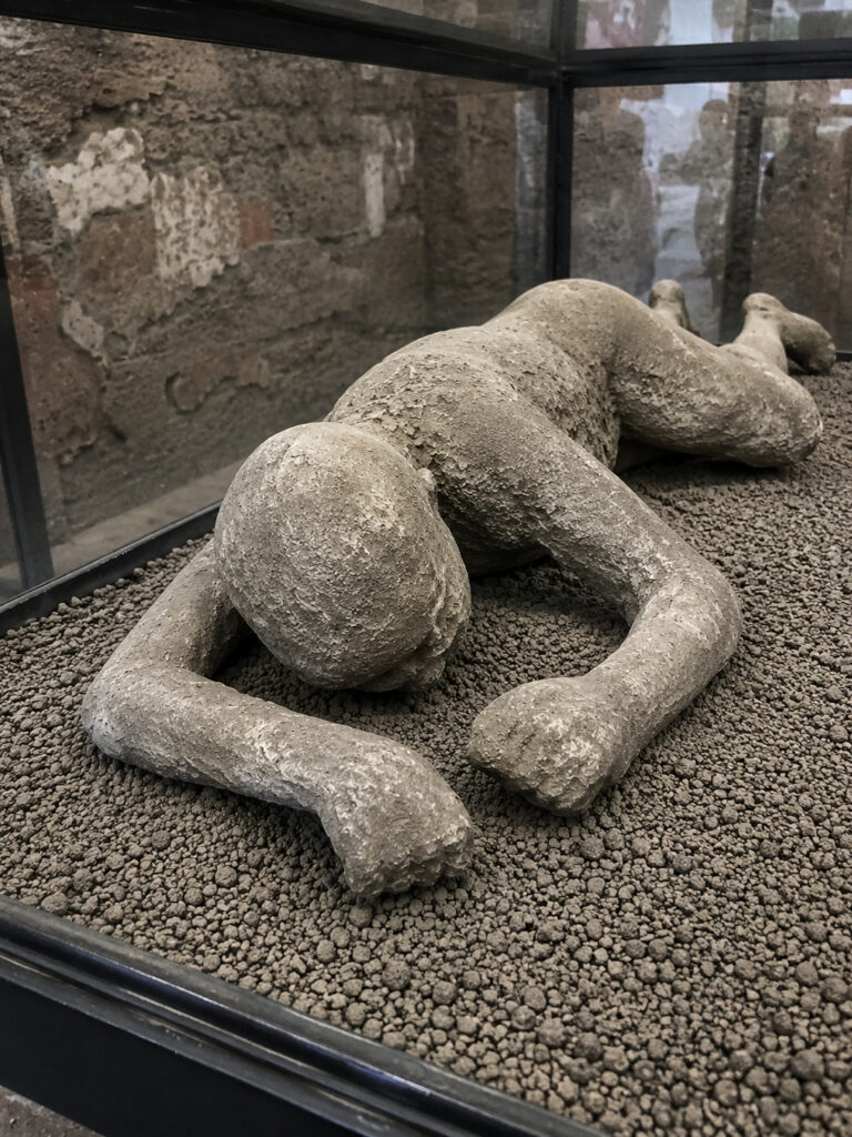
This is one of the most famous—and disturbing—aspects of Pompeii.
When people were buried under volcanic material, their bodies eventually decomposed and left cavities in the hardened ash. Centuries later, archaeologists discovered these cavities and carefully filled them with plaster.
The result was a plaster cast that preserves the shape and position of the person and, in some cases, details of their clothing.
The casts don’t actually contain the person’s body. Instead, they preserve the impression left behind after the body decomposed.
2. Mohenjo-daro
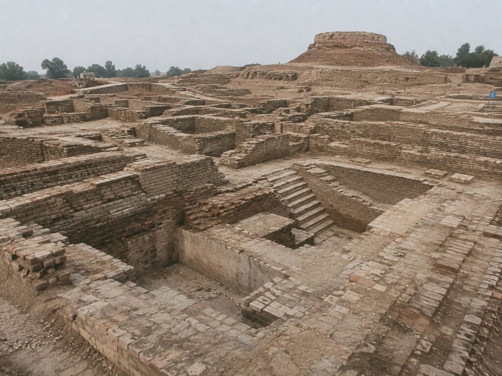
Mohenjo-daro is one of the most fascinating ancient cities ever discovered. Built around 4,500–5,000 years ago, it was a major city of the Indus Valley Civilization, also known as the Harappan Civilization.
Today, its ruins are in Sindh, Pakistan, near the Indus River and the modern city of Larkana. UNESCO considers Mohenjo-daro one of the world’s earliest major urban centers and one of the best-preserved examples of an early South Asian city from the beginning of the 3rd millennium BCE.
What makes Mohenjo-daro so impressive is how advanced its city was for its time. It had carefully planned streets, drainage systems, standardized brick construction, wells, houses, public buildings, and impressive ways of managing water—all developed thousands of years ago.
The Great Bath
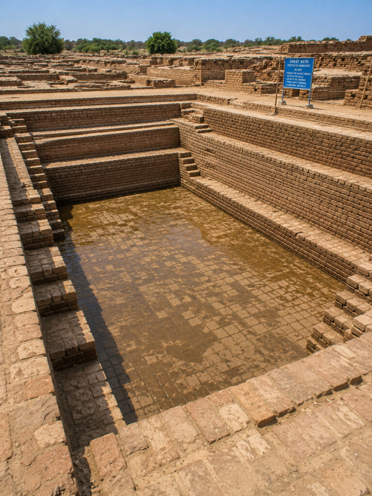
The Great Bath is probably the most famous structure at Mohenjo-daro. It is a large brick-built pool surrounded by rooms and passageways.
We still don’t know exactly what it was used for. Many archaeologists think it may have been connected to ritual or religious activities, but there isn’t enough evidence to say for sure.
And that’s one of the most interesting things about Mohenjo-daro: we know a lot about the city itself, but much less about the people who built and lived in it.
Did Mohenjo-daro have kings?
We simply don’t know.
Unlike ancient Egypt and some other civilizations, archaeologists haven’t found clear evidence of huge royal palaces or monumental royal tombs at Mohenjo-daro. This has led to a lot of debate about how the Indus cities were governed.
The civilization was clearly well organized and capable of building large, carefully planned cities. But exactly who was in charge, how political power worked, and whether the cities were ruled by kings remain unanswered questions.
3. Angkor
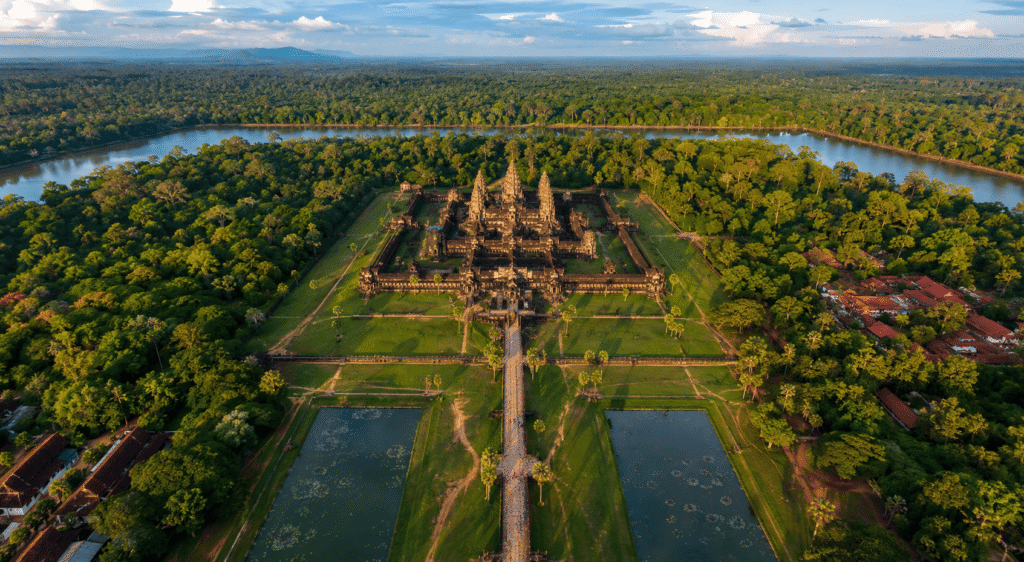
Angkor was one of the greatest urban and religious centers of the medieval world. Located in present-day Cambodia, it was the heart of the powerful Khmer Empire for centuries.
When people hear “Angkor,” they often think of Angkor Wat, the famous temple. But Angkor was much more than just one temple. It was a huge urban area filled with temples, reservoirs, canals, roads, royal buildings, and residential areas spread across a massive landscape.
At its peak, Angkor was one of the largest urban settlements in the premodern world.
The Khmer Empire
The Khmer Empire became one of the most powerful states in mainland Southeast Asia.
Its foundations are traditionally linked to Jayavarman II, who established his rule in the early 9th century. Later kings greatly expanded the empire and the city of Angkor. One of the most famous rulers was Jayavarman VII, who ruled in the late 12th and early 13th centuries.
During his reign, Angkor Thom and the impressive Bayon temple were developed, along with major roads, reservoirs, hospitals, and other infrastructure.
The incredible water system
One of Angkor’s most impressive features isn’t actually a temple. It’s the water-management system.
The city had enormous reservoirs called barays, along with canals, ponds, embankments, and other hydraulic structures. Water was essential for rice farming, supplying settlements, supporting religious complexes, managing seasonal rainfall, and sustaining the city’s large population.
This huge network of water infrastructure played an important role in helping Angkor support such a large and complex urban society.
4. Tikal
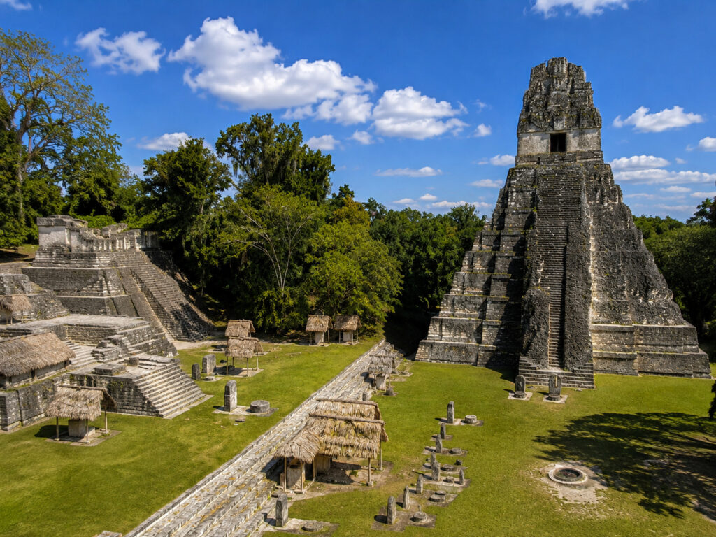
Tikal was one of the greatest cities of the ancient Maya civilization. Hidden for centuries beneath the rainforest of modern-day Guatemala, it was once a powerful political, economic, and religious center.
At its peak, Tikal had enormous pyramids rising above the jungle, along with huge plazas, palaces, temples, reservoirs, roads, and thousands of other buildings.
Today, Tikal is one of the most important archaeological sites in the Americas. It is also part of Tikal National Park, which is a UNESCO World Heritage Site.
Tikal’s powerful rulers
Tikal was ruled by a series of Maya kings.
One of the most important was Jasaw Chan K’awiil I, who ruled during the 7th and early 8th centuries. He is associated with several major building projects at Tikal, including Temple I, which was built as his funerary monument.
Another important ruler was Yik’in Chan K’awiil, who continued expanding Tikal’s impressive architecture and monuments.
These rulers weren’t just religious figures. Maya kings played important roles in politics, warfare, diplomacy, and religious ceremonies.
Why did Tikal decline?
During the 8th and 9th centuries CE, many major Maya cities in the southern lowlands went through periods of political and social collapse.
Tikal was no exception. There probably wasn’t one single reason for its decline. Instead, several problems may have played a role, including prolonged warfare, extended droughts, pressure on agriculture, population growth, water-management challenges, political instability, and the breakdown of traditional ruling systems.
By the 10th century, Tikal had largely stopped functioning as a major urban center.
But the Maya civilization itself did not disappear. Maya peoples and communities continue to live throughout the region today.
5. Herculaneum
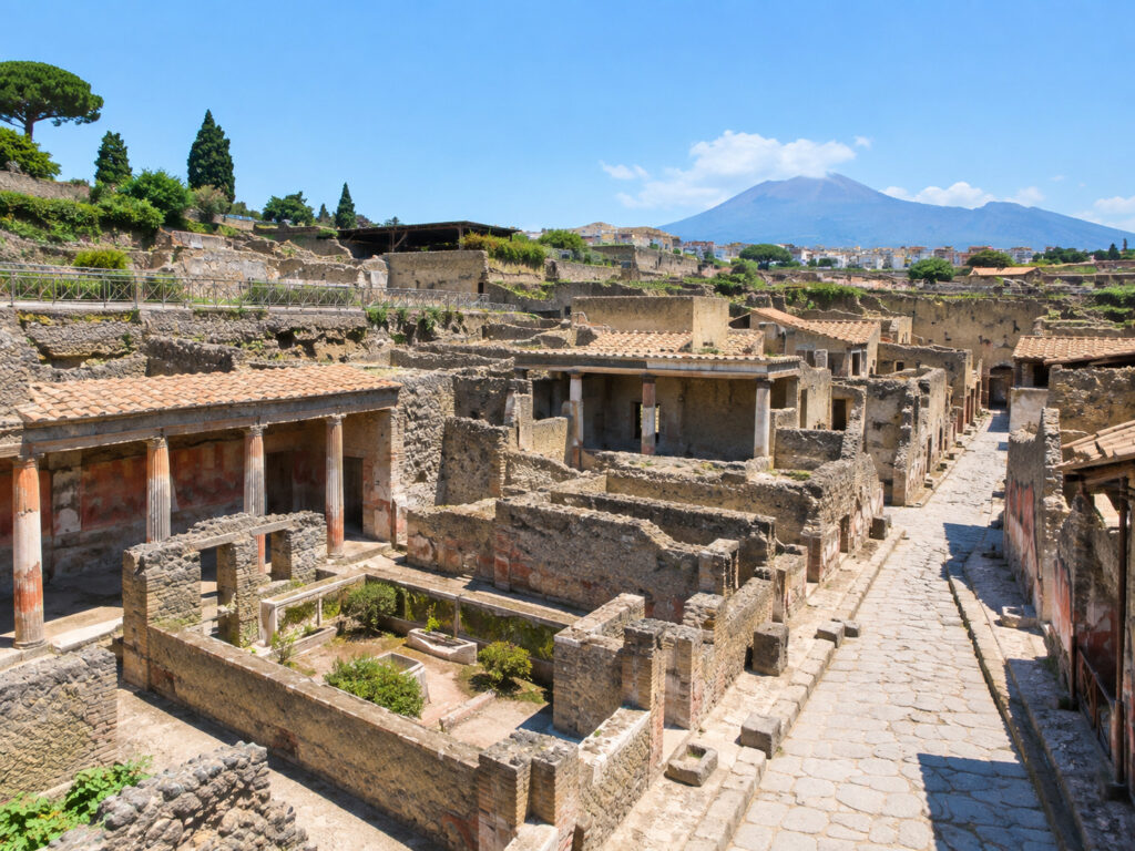
Herculaneum was an ancient Roman town on the coast of southern Italy that was buried by the eruption of Mount Vesuvius in AD 79.
It is often compared with Pompeii, but there is an important difference.
Pompeii was buried mainly by falling pumice and ash, while Herculaneum was eventually overwhelmed by extremely hot pyroclastic flows and surges. The rapid burial and unusual conditions helped preserve many organic objects remarkably well.
Because of this, Herculaneum gives us an incredible look at what Roman homes and everyday life were actually like.
What happened in AD 79?
When Mount Vesuvius erupted, Herculaneum was hit by extremely hot volcanic material.
Unlike Pompeii, where people were first exposed to falling ash and pumice, Herculaneum was eventually buried by pyroclastic flows and surges—fast-moving mixtures of hot gas, ash, and volcanic fragments.
The town was buried under roughly 15–20 meters of volcanic material.
The combination of rapid burial, intense heat, and low-oxygen conditions helped preserve things that would normally disappear over time.
Food from almost 2,000 years ago
Because of these unusual preservation conditions, archaeologists have discovered carbonized food and plant remains at Herculaneum. These discoveries give researchers clues about what people ate and how they stored their food.
Instead of finding only stone, pottery, and buildings, archaeologists have also uncovered surprisingly ordinary objects from everyday Roman life.
The houses were beautiful
Herculaneum was a wealthy town, and some of its houses were incredibly elaborate. Many contained colorful frescoes, marble decorations, mosaics, courtyards, gardens, private bathing facilities, and sculptures.
One particularly famous building is the House of the Neptune Mosaic, named after its spectacular mosaic decoration.
6. Ctesiphon
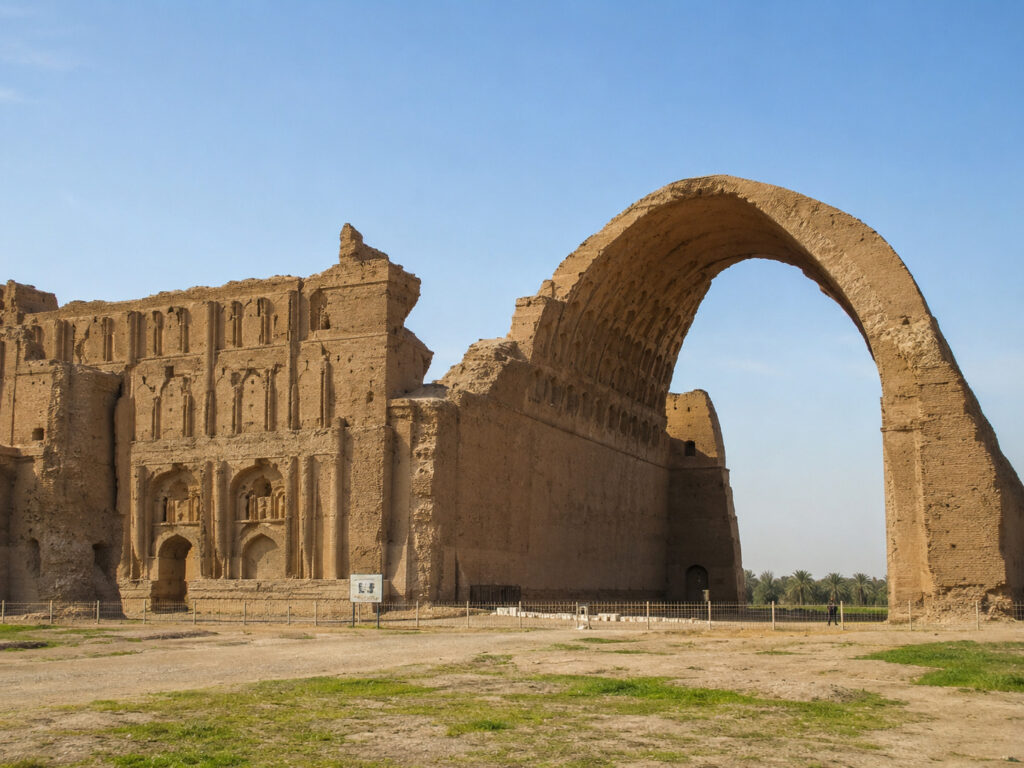
Ctesiphon was one of the most important cities of the ancient Near East and a major capital of the Parthian and Sasanian Empires.
Located along the Tigris River, near modern-day Baghdad, Ctesiphon was once a huge imperial center and one of the most important cities in the ancient world.
Today, very little of the ancient city remains above ground. But one massive structure still survives—the spectacular Taq Kasra, also known as the Arch of Ctesiphon.
A city of powerful empires
Ctesiphon became an important city under the Parthian Empire, which ruled much of Iran and Mesopotamia. Later, it became the principal capital of the Sasanian Empire, which emerged in the 3rd century CE.
For centuries, Ctesiphon was a major political and cultural center. It stood near the ancient city of Seleucia, and the two cities became part of a large urban area around the Tigris River.
The capital of the Sasanian Empire
Under the Sasanians, Ctesiphon grew into an impressive imperial capital.
The city was home to Persian kings, royal palaces, markets, religious buildings, scholars, farmers, workers, and merchants from different parts of the ancient world. Its location also made it an important center for trade, connecting Mesopotamia, Persia, the Mediterranean world, and Central Asia.
For centuries, Ctesiphon stood at the crossroads of powerful empires, cultures, and trade routes.
7. Great Zimbabwe
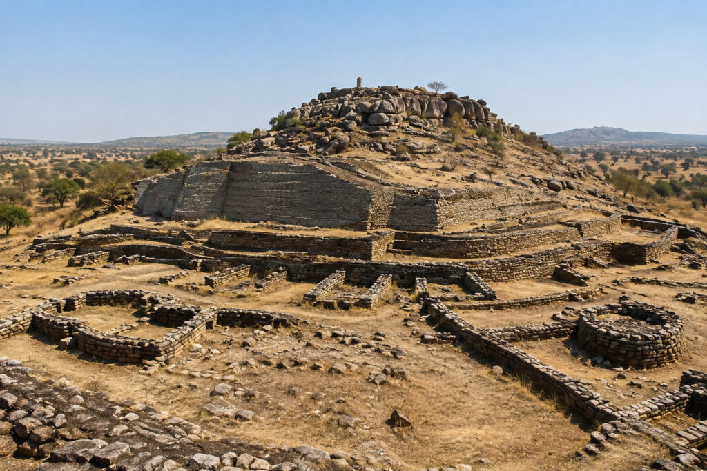
Great Zimbabwe is one of the most remarkable ancient cities in Africa. Located in modern-day Zimbabwe, it was the center of a powerful society that flourished between roughly the 11th and 15th centuries CE.
The city is famous for its enormous dry-stone walls, which were built without mortar. The most impressive of these is the spectacular Great Enclosure.
For a long time, some European writers falsely claimed that Great Zimbabwe must have been built by foreigners because they refused to believe that local African societies could have created such an impressive city. Archaeological evidence has completely disproved those claims.
Great Zimbabwe was built by the ancestors of the Shona-speaking peoples of southern Africa.
The Great Enclosure
The Great Enclosure is Great Zimbabwe’s most famous structure.
Its massive curved walls were made from carefully stacked granite blocks without mortar. Some sections of the walls reach around 11 meters (36 feet) high. One of its most recognizable features is the large Conical Tower, which stands inside the enclosure.
Its exact purpose is still uncertain, but it was clearly an important architectural and symbolic feature of the site.
Great Zimbabwe was a trading center
This is one of the most fascinating things about Great Zimbabwe.
The city was connected to a large Indian Ocean trading network. Archaeologists have found objects from distant regions, including Chinese ceramics, Persian and Middle Eastern goods, Islamic ceramics, glass beads, coins, and items linked to the coastal regions of East Africa.
These discoveries show that Great Zimbabwe wasn’t an isolated settlement.
It was connected to trade routes stretching from the African interior to the Swahili Coast and the wider Indian Ocean world.
Gold and other valuable resources from the interior were particularly important to these trading networks, helping Great Zimbabwe become an important center of regional trade.
8. Ani
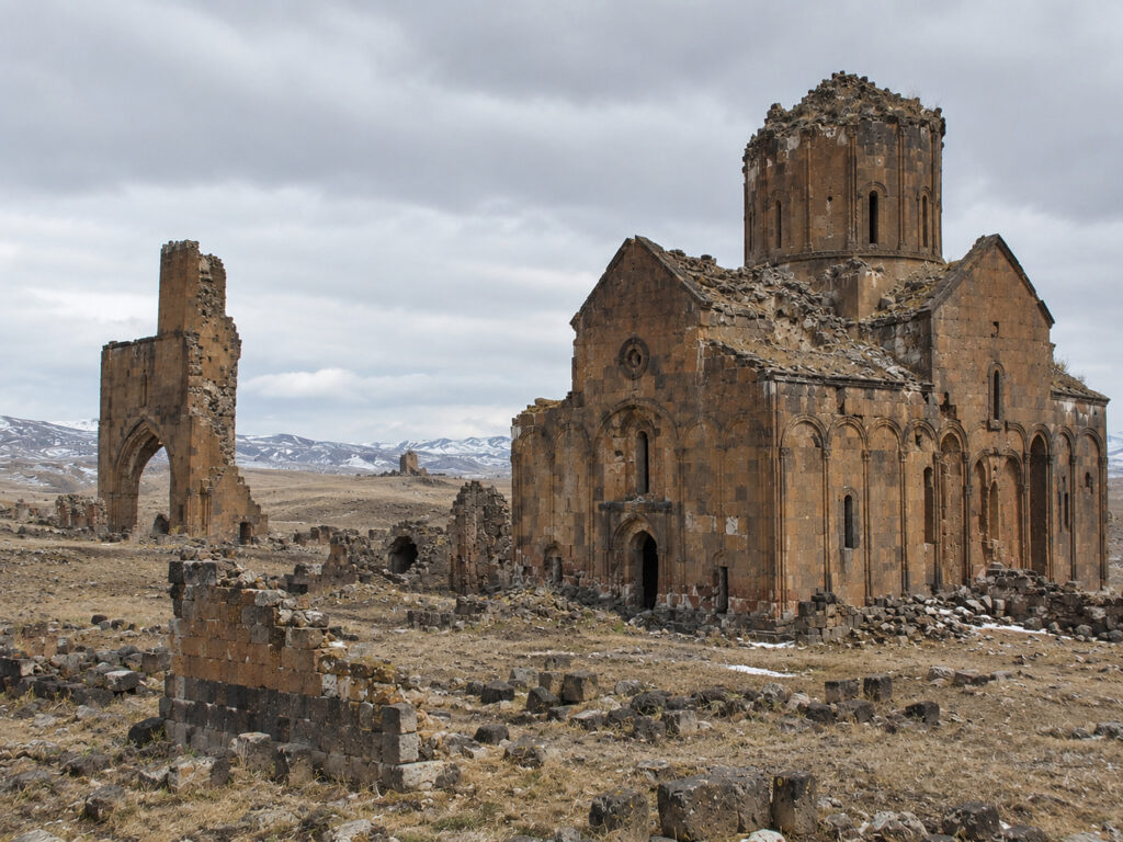
Ani was one of the most remarkable medieval cities of the Caucasus. Located in modern-day eastern Turkey, close to the Armenian border, it was once the capital of the Bagratid Armenian Kingdom and an important center of trade, religion, architecture, and culture.
Today, Ani is largely abandoned, and its ruins sit dramatically on a windswept plateau.
The city is often called the “City of 1,001 Churches,” although the number is more legendary than literal.
The Golden Age of Ani
Ani became the capital of the Bagratid Armenian Kingdom under King Ashot III in the 10th century.
The city reached its greatest importance under rulers such as Smbat II and Gagik I. During this period, Ani grew rapidly and became a wealthy center of trade, architecture, religion, art, scholarship, and political power.
It became one of the major cities of the medieval Caucasus.
How did Ani become a “lost city”?
Unlike Pompeii, Ani wasn’t destroyed by one huge disaster. Its decline happened gradually over several centuries.
Wars, earthquakes, changing political borders and trade routes, and economic decline all contributed to the city’s downfall.
As people left, buildings slowly deteriorated. Eventually, a once-busy medieval city became largely abandoned. Grass and vegetation spread through its streets, while many of its churches, walls, and other structures remained standing.
That’s what makes Ani so haunting today—a once-thriving city now sits almost empty, with its ruins scattered across the landscape.
9. Teotihuacan
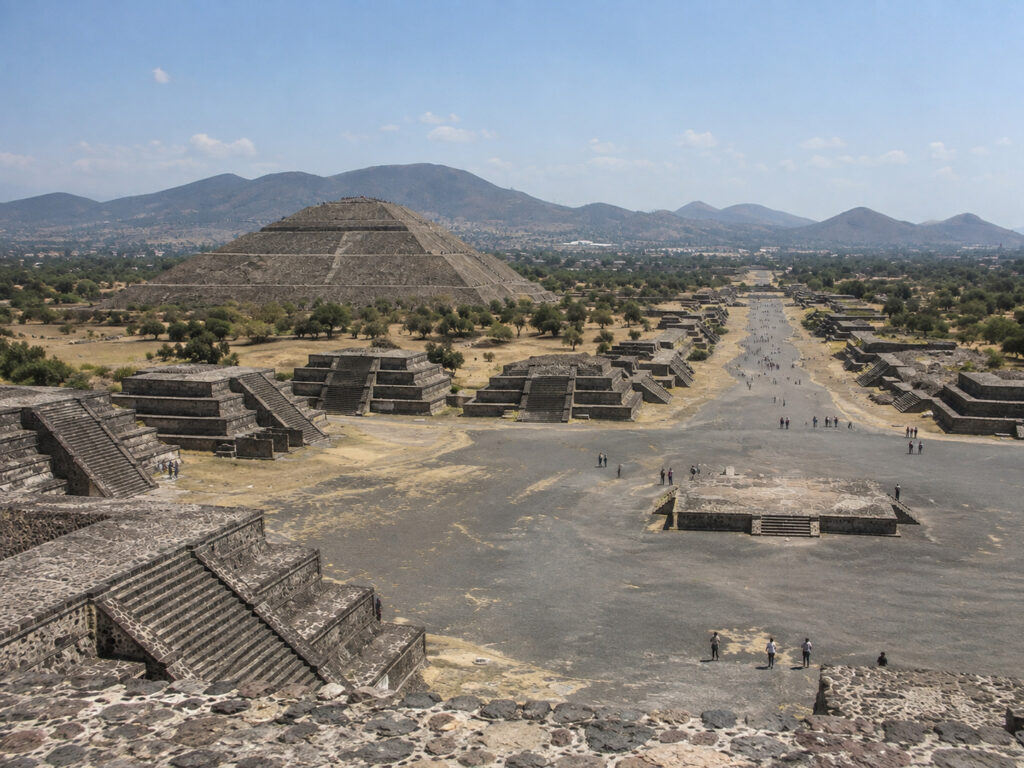
Teotihuacan was one of the largest and most influential cities of the ancient Americas. Located in modern-day Mexico, about 40 km (25 miles) northeast of Mexico City, it became a huge urban center centuries before the rise of the Aztec Empire.
At its peak, Teotihuacan may have been home to 100,000–150,000 people or even more, making it one of the largest cities in the ancient world. Its enormous pyramids, carefully planned streets, apartment compounds, temples, murals, and mysterious origins make it one of the most fascinating “lost cities” in history.
And there’s a major mystery: we don’t actually know what the people who founded Teotihuacan originally called the city. The name Teotihuacan was given centuries later by the Aztecs.
The Avenue of the Dead
The city’s enormous central avenue stretches for roughly 2 km (1.2 miles). Despite its modern name, it probably wasn’t actually a “road of the dead.” The name was given much later by the Aztecs.
Along the avenue were temples, plazas, pyramids, and residential areas. Standing there today gives you a good idea of just how carefully planned and impressive the city once was.
The City Was Once Colorful
One thing that surprises many visitors is that Teotihuacan wasn’t always the bare gray stone site we see today. Its buildings were covered with plaster and brightly painted decorations.
Archaeologists have found murals showing jaguars, birds, serpents, plants, human figures, and religious imagery. Imagine those enormous pyramids and buildings covered in bright colors instead of the bare stone we see today.
10. Cahokia
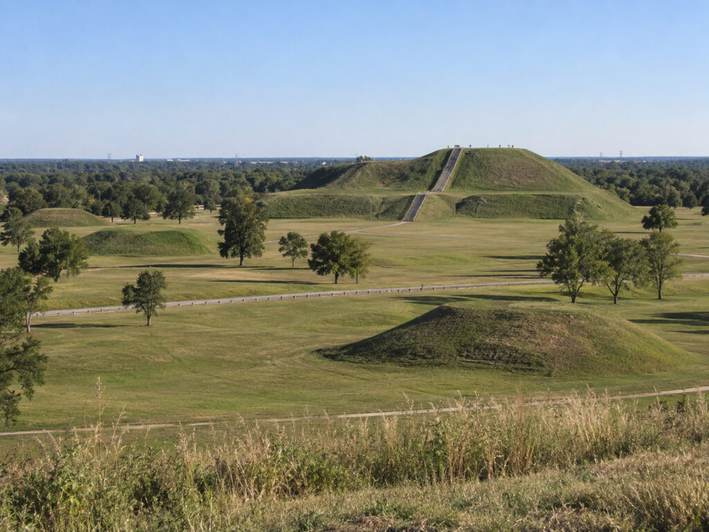
Cahokia was one of the greatest cities of ancient North America. Located near present-day St. Louis, Missouri, and across the Mississippi River in Illinois, it was the largest and most influential urban center of the Mississippian culture.
At its height, around 1050–1250 CE, Cahokia may have had 10,000–20,000 people living in the central settlement, while the wider region supported an even larger population.
Its enormous earthen pyramids, open plazas, neighborhoods, ceremonial structures, and highly organized society show that complex urban civilization existed in North America long before European colonization.
A City of Enormous Earthen Monuments
Cahokia wasn’t built from stone like Teotihuacan or Great Zimbabwe. Instead, its people moved millions of baskets of earth to create enormous platform and conical mounds.
The site originally had around 120–200 mounds, depending on how they are classified and reconstructed. These mounds had different purposes, including supporting important buildings, serving as burial and ceremonial sites, supporting elite structures, hosting religious activities, and showing political power.
The city was also organized around large open plazas where people could gather for ceremonies, celebrations, and other important events.
11. Leptis Magna
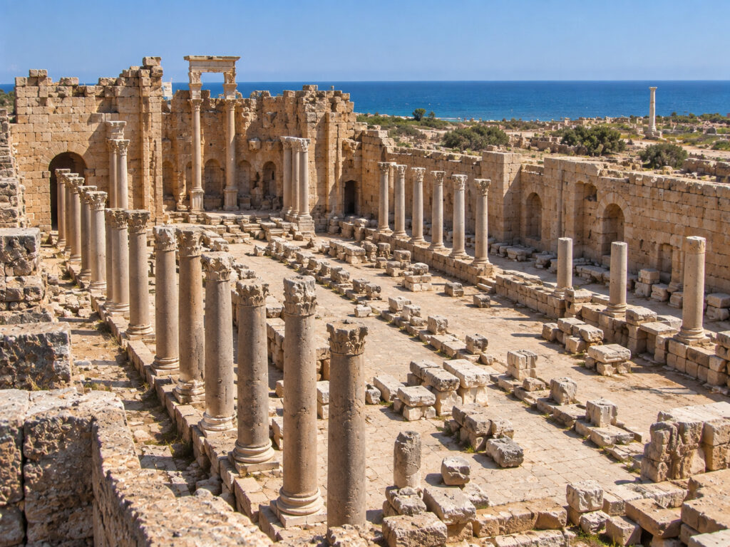
Leptis Magna was one of the greatest cities of the ancient Roman world. Located on the Mediterranean coast of modern-day Libya, it began as a Phoenician settlement, later became part of the Carthaginian world, and eventually grew into a wealthy and impressive Roman city.
Its golden age came under the Roman emperor Septimius Severus, who was born there. Today, Leptis Magna is an incredible archaeological site, with huge streets, arches, basilicas, markets, baths, temples, theaters, and a massive harbor still standing.
It is often considered one of the best-preserved Roman cities in the Mediterranean.
From Phoenician Settlement to Roman City
Leptis Magna was originally founded by Phoenician settlers, probably around the 7th century BCE. It later came under the influence of Carthage and eventually became part of the Roman world.
Under Roman rule, the city became extremely wealthy thanks to its location on the Mediterranean coast and its connections with the African interior. Its economy benefited from trade in olive oil, grain, ivory, other African goods, agricultural products, and manufactured goods.
The Decline of Leptis Magna
Leptis Magna’s fortunes eventually began to change. Several factors contributed to its decline, including political instability, changes in the surrounding environment, economic difficulties, problems with the port, regional conflicts and attacks, and the decline of long-distance trade.
The city suffered particularly during the later Roman and Byzantine periods. By the 7th century CE, Arab armies had conquered the region, and Leptis Magna was largely abandoned. Over time, sand and sediment covered parts of the city, helping to preserve many of its impressive ruins.
12. Merv
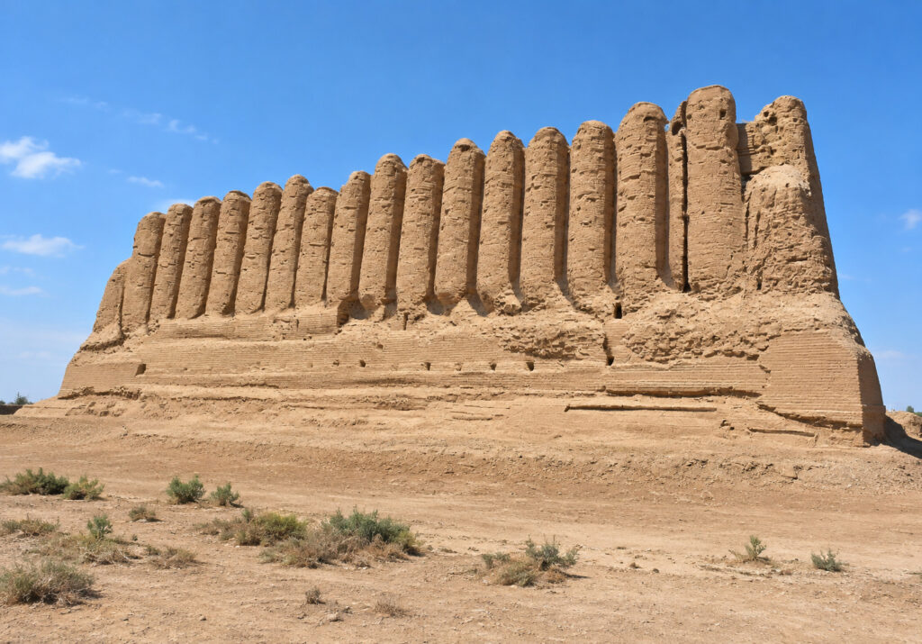
Merv was one of the greatest cities of the ancient and medieval world. Located in the Murghab River oasis in modern-day Turkmenistan, it wasn’t just one city that rose and fell. Instead, it was a series of cities built in the same oasis over roughly 4,000 years.
At different times, Merv was an important Persian, Hellenistic, Parthian, Sasanian, Islamic, and Seljuk center. During its medieval golden age, it became one of the most important cities of the Great Seljuk Empire, as well as a major center of trade, learning, and culture in Central Asia.
Merv Was Actually a Succession of Cities
One of the most unusual things about Merv is that archaeologists don’t find just one ancient city. The archaeological area contains the remains of several major settlements that were built and expanded at different times.
Some of the most important areas include Erk Kala, one of the oldest fortified settlements at Merv, with origins going back to the Achaemenid period; Gyaur Kala, the huge urban settlement that developed around Erk Kala and grew especially during the Hellenistic and later periods; and Sultan Kala, the great medieval Islamic city that became the most famous part of Merv.
Other settlements, including Abdullah Khan Kala and Bairam Ali Khan Kala, show that the area remained important even after its earlier golden ages. So when we talk about “Merv,” we’re really talking about a huge archaeological complex containing several generations of cities.
A City of Scholars
Merv wasn’t just a major trading center. It also became famous for its intellectual life. Scholars connected with the city worked in fields such as astronomy, mathematics, medicine, geography, Islamic law, philosophy, and literature.
One famous scholar associated with Merv was Omar Khayyam, the Persian mathematician, astronomer, and poet, who spent time there during the Seljuk period. Merv also had a strong tradition of astronomy, with scholars studying the stars and working to improve astronomical observations and calculations.
The Mongol Destruction
This was one of the darkest chapters in Merv’s long history. In 1221, Mongol forces led by Tolui, the son of Genghis Khan, attacked the city. Merv was captured and suffered devastating destruction. Medieval sources give enormous numbers for the people who were killed, but these figures are considered unreliable and shouldn’t be treated as exact population or casualty statistics.
What is clear is that the Mongol conquest caused a huge demographic and economic collapse. Merv never fully recovered its former importance. Over the following centuries, the city gradually declined, and much of the once-great urban center was eventually abandoned.
13. Palmyra
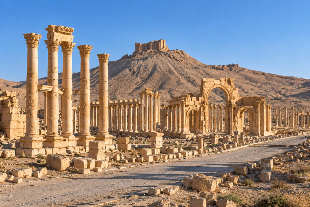
Palmyra—also known as ancient Tadmor—was one of the most remarkable cities of the ancient Near East. Built around an oasis in the Syrian Desert, it became incredibly wealthy by controlling caravan trade between the Roman Mediterranean and places such as Persia, Arabia, India, and even China.
At its height, Palmyra was a multicultural city where Aramaic, Roman, Greek, Persian, and Arab influences came together. Its most famous ruler, Queen Zenobia, even challenged the Roman Empire for a short time.
Today, Palmyra is both an incredible archaeological site and a painful reminder of how much cultural heritage can be damaged by modern war. The ancient city has suffered major destruction in recent conflicts, although restoration, documentation, and preservation efforts continue.
Palmyra’s Spectacular Architecture
At its height, Palmyra was filled with impressive monuments and grand buildings. One of its most famous features was the Great Colonnade, a huge avenue lined with massive columns that ran through the heart of the city and connected important districts and monuments.
The Roman Theater was another impressive structure, showing how strongly Greco-Roman architectural ideas had influenced the city. Then there was the Tetrapylon, a monumental structure made up of four groups of columns placed at an important intersection of the city’s streets.
It became one of Palmyra’s most recognizable landmarks. The Agora, meanwhile, served as an important marketplace and a busy center of commercial activity.
Palmyra Becomes Part of the Roman World
Palmyra gradually came under Roman influence and was incorporated into the Roman Empire during the 1st century CE. But Rome didn’t simply erase Palmyra’s unique identity.
The city kept a significant degree of local autonomy and continued to be governed by its own local elites. As a result, Palmyra became something of a Roman-connected city with a distinctly eastern identity.
Its merchants traveled across the region, while its soldiers played an important role along the empire’s eastern frontier. This mix of cultures and connections helped make Palmyra one of the most fascinating cities of the ancient Near East.
14. Dholavira
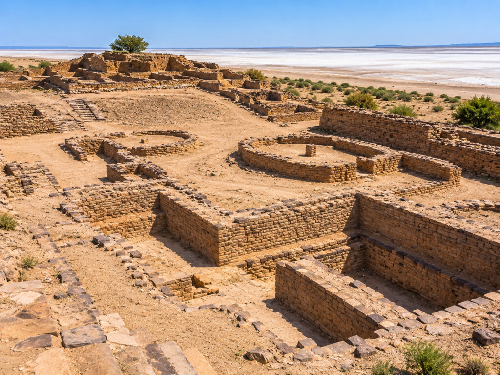
Dholavira was one of the greatest cities of the Indus Valley (Harappan) Civilization and one of the most remarkable archaeological sites in India. Located on the dry island of Khadir Bet in Gujarat’s Kutch region, Dholavira was occupied for roughly 1,500 years, with its major urban phase beginning around 3000 BCE.
Its people built a remarkably well-planned city with massive fortifications, organized neighborhoods, advanced drainage systems, and an impressive network of reservoirs for collecting and storing water.
Unlike many other ancient cities, Dholavira’s greatest achievement wasn’t a huge palace or pyramid. Instead, it was the way its people planned the entire city, especially how they managed one of the most important resources in such a dry environment: water.
A Remarkably Planned City
Dholavira wasn’t simply a collection of houses. The city was carefully divided into different areas, each with its own purpose. Archaeologists have identified major sections including the Citadel, the most heavily fortified and architecturally important part of the settlement; the Middle Town, a planned urban area between the citadel and lower town; and the Lower Town, a larger area containing homes, workshops, and other structures.
This careful organization shows how advanced the people of Dholavira were when it came to urban planning and the use of social space.
Discovery and Excavation
Dholavira was identified as an archaeological site in 1967–68 by J. P. Joshi of the Archaeological Survey of India. Major excavations were carried out later, especially under archaeologist R. S. Bisht.
Archaeologists uncovered fortifications, reservoirs, streets, houses, workshops, gates, burial structures, pottery, beads, seals, and inscriptions written in the Indus script. These discoveries completely changed our understanding of how advanced Harappan cities could be, especially when it came to urban planning, water management, trade, and construction.
15. Machu Picchu
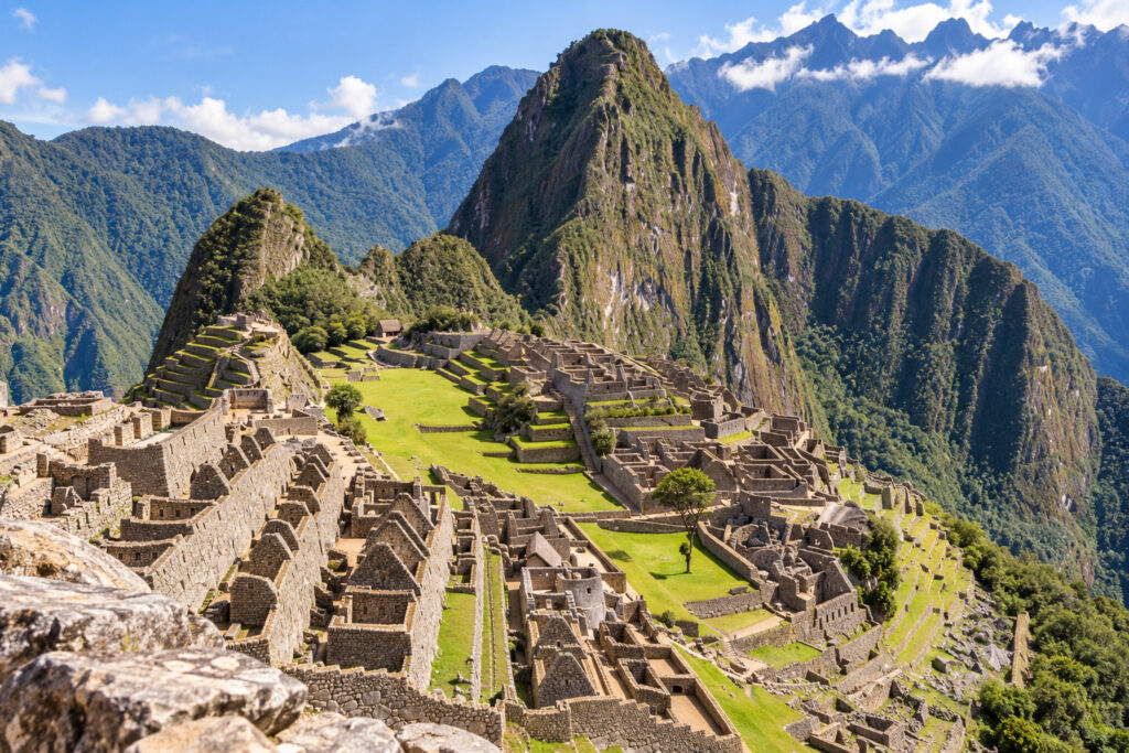
Machu Picchu is one of the most spectacular archaeological sites in the world—and one of the most famous surviving achievements of the Inca civilization.
Hidden high in the Andes of Peru, it was built in the 15th century, probably as a royal estate associated with the Inca ruler Pachacuti. The site combines palaces, temples, terraces, roads, water channels, and carefully engineered stonework with an extraordinary mountain landscape.
What makes Machu Picchu particularly fascinating is that we still don’t know exactly why it was built or what its full purpose was.
Why Was Machu Picchu Abandoned?
This is where Machu Picchu differs from many other “lost cities.” There is no evidence that a gigantic battle destroyed it.
Instead, the site appears to have been abandoned sometime during the 16th century, around the period when the Spanish conquest disrupted and eventually destroyed the Inca Empire.
UNESCO states that Machu Picchu was built in the 15th century and abandoned in the 16th century, during the period of the Spanish conquest.
The exact circumstances surrounding its abandonment remain uncertain. It may have been affected by the wider political and social upheaval caused by the Spanish invasion, although there is no single confirmed explanation.
Importantly, the Spanish apparently never discovered and occupied Machu Picchu during their conquest in the same way they did major Inca centers such as Cusco.
Its remote location high in the Andes helped protect it from large-scale colonial destruction, allowing much of the site to survive for centuries.
Hiram Bingham and 1911
Machu Picchu became internationally famous in 1911, when American explorer and historian Hiram Bingham visited the ruins with the help of local residents.
This is often described as the “discovery of Machu Picchu,” but that description is misleading. Local people already knew about the ruins.
Bingham’s importance was that he helped bring the site to the attention of the international academic and popular world. UNESCO likewise identifies 1911 as the year when Machu Picchu was introduced to the outside world.
Bingham later conducted archaeological investigations at the site and removed numerous artifacts and other materials for study. Many of these objects were taken to Yale University, leading to a long-running dispute between Yale and Peru over their ownership and eventual return.
Today, Machu Picchu is recognized as one of the world’s most important archaeological and cultural heritage sites.
Final Thoughts
From Pompeii’s volcanic ruins and Mohenjo-daro’s ancient streets to Angkor’s jungle-covered temples and Dholavira’s sophisticated water systems, lost cities give us a fascinating glimpse into civilizations that shaped human history.
Some were destroyed suddenly. Others declined slowly over centuries. And for some, we still don’t know exactly what caused their disappearance. That mystery is part of what makes them so fascinating.
They existed. People lived there. Entire societies grew and flourished there. And then, somehow, these once-thriving cities were lost to history.
Today, their ruins are more than just ancient stones and abandoned buildings. They are reminders of the people who built them, the civilizations they created, and how even the greatest cities can eventually disappear.