Nature is full of incredible places that almost don’t feel real. From towering mountains and crystal-clear lakes to colorful coral reefs, ancient forests, and unique wildlife, these natural wonders have earned a place on UNESCO’s World Heritage List because of their incredible beauty, biodiversity, and importance.
Whether you’re a nature lover, photographer, or simply someone who enjoys exploring new places, these 25 Natural UNESCO World Heritage Sites deserve a spot on your travel bucket list.
If you’re interested in exploring more UNESCO sites, you can also read our guide to 24 Cultural UNESCO World Heritage Sites You Must Visit.
1. Great Barrier Reef
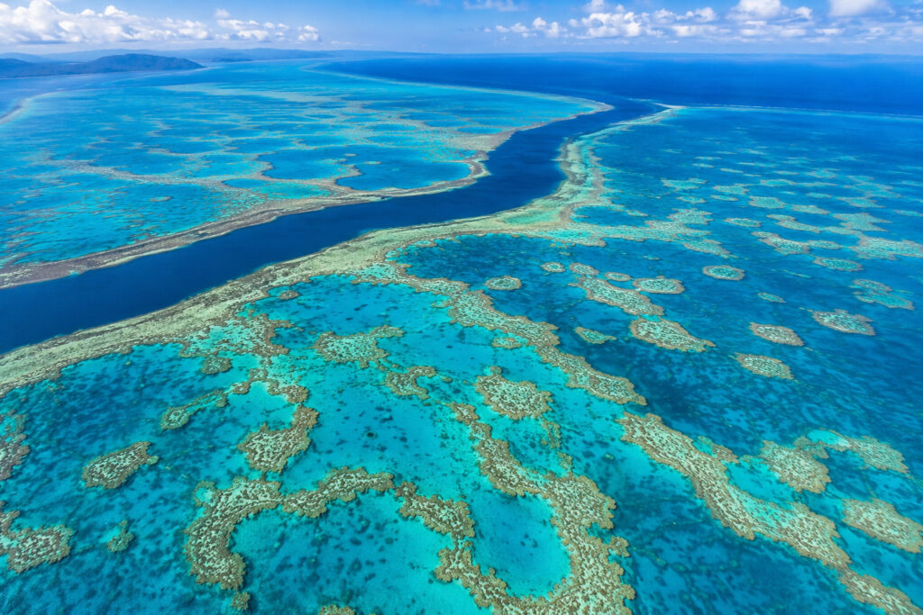
Great Barrier Reef is the largest coral reef system on Earth and one of the world’s most amazing natural wonders. Stretching over 2,300 km (1,430 miles) along the northeast coast of Australia, it’s so huge that it can even be seen from space under the right conditions.
The reef is located off the coast of Queensland, Australia. It starts near Bundaberg in the south and stretches north past Cairns to the Torres Strait. Covering about 133,000 square miles (344,400 square kilometers), it includes around 2,900 individual reefs and more than 900 islands, making it the world’s largest coral reef system.
The Great Barrier Reef is famous for its crystal-clear water, colorful coral gardens, tropical islands, and incredible marine life. Every year, millions of people visit to snorkel, scuba dive, take boat tours, and experience one of the most diverse ecosystems on the planet.
How Was It Formed?
The Great Barrier Reef didn’t form overnight. It took hundreds of thousands of years to grow. Tiny marine animals called coral polyps build hard skeletons made of calcium carbonate (limestone). When they die, their skeletons stay in place, and new corals grow on top of them. Over many generations, these layers slowly built the massive reef we see today.
The reef we see today mostly developed after the last Ice Age, around 8,000 to 10,000 years ago, when rising sea levels created the ideal conditions for coral growth.
What Is Coral?

Many people think coral is a rock or a plant, but it is actually a living animal. A coral colony is made up of thousands of tiny animals called polyps that live together and build hard skeletons made of calcium carbonate. Although each polyp is tiny, they work together to form beautiful coral reefs that provide food and shelter for thousands of marine species.
The bright colors of coral reefs come partly from microscopic algae called zooxanthellae, which live inside coral tissues. These algae help corals by giving them their vibrant colors, producing food through photosynthesis, and providing energy they need to grow. Because these algae need sunlight, most reef-building corals grow in clear, shallow waters.
Marine Life

The Great Barrier Reef is home to an incredible variety of marine life, from colorful fish and corals to sea turtles, sharks, dolphins, and dugongs. More than 1,600 fish species live in the reef, including clownfish, parrotfish, butterflyfish, angelfish, groupers, wrasses, and barracuda.
The reef is also home to more than 600 species of hard and soft corals, which create the colorful underwater habitats that many marine animals depend on.
Several species of sharks can also be found here, including reef sharks, tiger sharks, hammerhead sharks, and whale sharks, which are seasonal visitors to some parts of the reef. Six of the world’s seven species of marine turtles can be found in the Great Barrier Reef. These include the green turtle, hawksbill turtle, loggerhead turtle, leatherback turtle, flatback turtle, and olive ridley turtle. Other marine animals found throughout the reef include dolphins, dugongs, manta rays, giant clams, sea snakes, octopuses, jellyfish, and seahorses.
Great Barrier Reef is also an important habitat for dugongs, large marine mammals that are closely related to elephants. They mainly feed on seagrass and spend much of their time in shallow coastal waters.
The reef islands are also home to more than 200 species of birds, including white-bellied sea eagles, terns, frigatebirds, and herons.
Popular Activities
The Great Barrier Reef offers something for everyone. Visitors can enjoy scuba diving, snorkeling, glass-bottom boat tours, sailing, island hopping, kayaking, whale watching, wildlife photography, and even scenic helicopter flights for breathtaking views from above.
Heart Reef

One of the Great Barrier Reef’s most famous attractions is Heart Reef, a naturally heart-shaped coral formation in the Whitsundays. The best way to see Heart Reef is on a helicopter or seaplane tour because it’s protected. Swimming, snorkeling, and diving at Heart Reef are not allowed to help preserve this fragile ecosystem.
Coral Bleaching

Coral bleaching happens when ocean temperatures stay too warm for a long time. During this process, corals lose the tiny algae called zooxanthellae that live inside them and give them their bright colors. As a result, the corals turn white and become stressed.
Bleached coral doesn’t die immediately, and if the water cools down soon enough, it can recover. However, if high temperatures continue for too long, the coral may die. Frequent bleaching events make it much harder for reefs to recover and threaten the thousands of marine species that depend on them.
Climate
Great Barrier Reef has a tropical climate with warm weather all year.
Summer (December–February) is hot, humid, and rainy. Water temperatures usually range from 81–86°F (27–30°C), and tropical storms or cyclones can sometimes occur.
Winter (June–August) is cooler, drier, and more comfortable. Water temperatures stay between 72–77°F (22–25°C), making it a great time for outdoor activities. Most travelers prefer to visit between June and October because the weather is pleasant, rainfall is lower, and the water is clearer, making snorkeling and diving even better.
2. Yellowstone National Park

Yellowstone National Park is the world’s first national park, established on March 1, 1872. It is one of the most famous protected areas on Earth, known for its spectacular geysers, colorful hot springs, waterfalls, deep canyons, forests, wildlife, and vast volcanic landscape.
Located in the northwestern United States, most of the park (about 96%) lies in Wyoming, while smaller portions extend into Montana (3%) and Idaho (1%). Covering nearly 3,472 square miles (8,991 sq km), Yellowstone is home to more than half of the world’s active geysers. The park also sits above one of the largest volcanic systems on Earth—the Yellowstone Caldera, often called a supervolcano.
Why Is It Famous?
Yellowstone is famous for many reasons. It was the world’s first national park and has the greatest concentration of hydrothermal features anywhere on Earth. The park contains more than 10,000 hydrothermal features, including over 500 active geysers, which is more than half of the world’s total. It’s also home to incredible wildlife such as American bison, wolves, grizzly bears, black bears, elk, moose, and bighorn sheep. Along with its wildlife, Yellowstone is known for its dramatic landscapes, including waterfalls, rivers, mountains, forests, lakes, and the massive Yellowstone Caldera beneath the park.
History
Long before Yellowstone became a national park, Indigenous peoples had lived in and visited the area for thousands of years. They hunted, fished, gathered plants, and used the region’s geothermal features for practical and cultural purposes.
During the early 1800s, explorers and mountain men began reporting Yellowstone’s unusual geothermal activity. After the Washburn-Langford-Doane Expedition in 1870, along with photographs taken by William Henry Jackson, the U.S. government recognized the area’s unique natural value. On March 1, 1872, President Ulysses S. Grant signed the law creating Yellowstone National Park, making it the first national park in the world.
How Was Yellowstone Formed?
Yellowstone was formed by volcanic activity over millions of years. A hotspot beneath the Earth’s crust slowly melts rock, creating large amounts of magma. Over time, several massive volcanic eruptions formed a huge volcanic depression known as the Yellowstone Caldera.
Although the last major eruption happened about 640,000 years ago, the underground heat is still active today. It powers Yellowstone’s famous geysers, hot springs, mud pots, and steam vents.
The Yellowstone Supervolcano
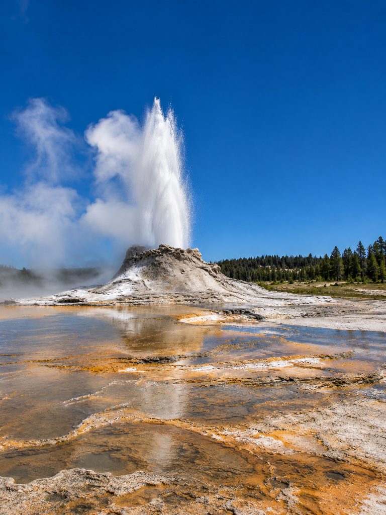
The Yellowstone Caldera is one of the largest volcanic systems in the world. It measures about 30 by 45 miles (48 by 72 km) and is heated by a large underground magma system. Scientists constantly monitor the area for earthquakes, ground movement, and geothermal activity.
Despite its nickname as a supervolcano, there is no evidence that a major eruption is expected anytime soon. Small earthquakes, ground movement, and changes in geothermal activity are normal and part of how the volcanic system naturally works.
Hydrothermal Features
Yellowstone has the world’s greatest concentration of hydrothermal features, making it one of the most unique places on Earth.
A. Geysers

Geysers erupt when underground water is heated by magma beneath the Earth’s surface. Yellowstone has more than 500 active geysers, more than anywhere else in the world. The most famous is Old Faithful, which erupts approximately every 60 to 110 minutes, shooting hot water up to about 185 feet (56 meters) into the air.
B. Hot Springs

Hot springs are pools of naturally heated groundwater. Their bright colors come from heat-loving microorganisms that thrive in different water temperatures. The most famous is Grand Prismatic Spring, the largest hot spring in the United States and one of Yellowstone’s most photographed attractions.
C. Mud Pots
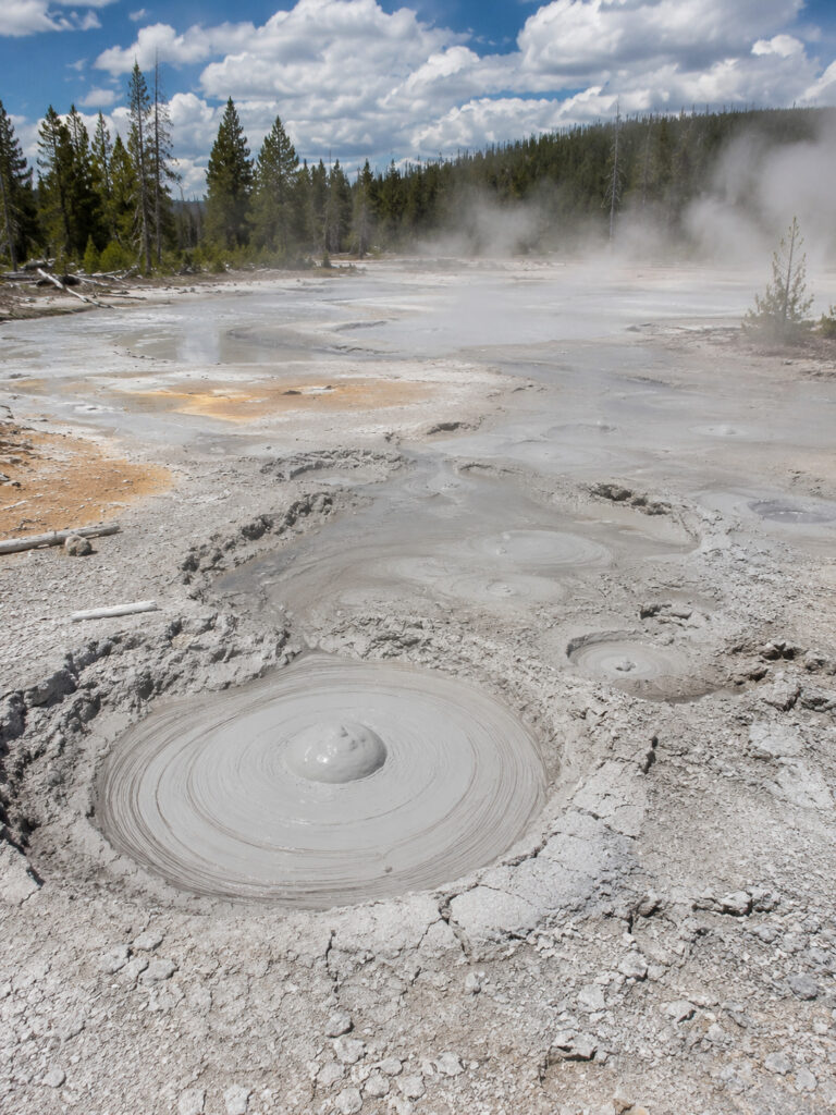
Mud pots form when acidic water breaks down surrounding rocks into clay, creating bubbling pools of thick mud. These fascinating features are constantly changing as hot gases escape from below.
D. Fumaroles

Fumaroles, also called steam vents, are openings in the Earth’s surface that release hot steam and volcanic gases. They are among the hottest hydrothermal features found in Yellowstone.
Yellowstone Lake

Yellowstone Lake is one of the largest high-elevation lakes in North America. It covers about 136 square miles (352 sq km) and sits at an elevation of more than 7,700 feet (2,350 meters) above sea level. Parts of the lake also contain underwater hydrothermal features, showing that volcanic activity continues beneath its surface.
Grand Canyon of the Yellowstone

The Grand Canyon of the Yellowstone is one of the park’s most breathtaking natural attractions. Carved by the Yellowstone River, the canyon stretches about 20 miles (32 km) and reaches depths of up to 1,200 feet (366 meters). Its colorful yellow, orange, and red rock walls make it one of the most photographed places in the park. Artist Point is considered one of the best viewpoints for seeing the canyon and the famous Lower Falls.
Climate
Yellowstone has a mountain climate with long, cold winters and short, mild summers.
Summer (June–August) brings pleasant daytime temperatures, cool nights, and frequent afternoon thunderstorms, making it the busiest season for visitors.
Winter (December–February) is cold and snowy, with temperatures often staying below freezing. Heavy snowfall causes many park roads to close to regular vehicles, although some areas remain accessible by snowcoach or snowmobile.
3. Galápagos Islands

Galápagos Islands are one of the most extraordinary wildlife destinations on Earth. Located in the Pacific Ocean, about 620 miles (1,000 km) west of mainland Ecuador, this volcanic archipelago is famous for its unique wildlife, dramatic landscapes, and its important role in shaping Charles Darwin’s theory of evolution by natural selection.
The islands belong to Ecuador and lie almost directly on the Equator, allowing visitors to experience both the Northern and Southern Hemispheres. Often called a “living laboratory of evolution,” the Galápagos are home to many plants and animals found nowhere else on Earth.
Because of their incredible biodiversity and scientific importance, the Galápagos Islands became one of the world’s first UNESCO World Heritage Sites in 1978.
Why Are They Famous?
Galápagos Islands are famous for inspiring Charles Darwin’s theory of evolution by natural selection. They are home to an exceptionally high number of endemic species, meaning many of the animals and plants found here exist nowhere else on Earth. The islands are also known for their active volcanoes, stunning lava landscapes, crystal-clear waters, and some of the world’s best wildlife viewing. To help protect this unique ecosystem, most of the islands are preserved as Galápagos National Park, while the surrounding waters are protected as the Galápagos Marine Reserve.
History
People may have visited the islands before they were officially recorded, but the first documented European discovery happened in 1535, when Tomás de Berlanga, the Bishop of Panama, drifted there by accident.
Nearly 300 years later, in 1835, Charles Darwin visited the islands aboard the HMS Beagle. By studying finches, giant tortoises, and other wildlife, he noticed that animals had adapted differently on different islands. These observations later became the foundation of his groundbreaking theory of evolution by natural selection.
How Were the Islands Formed?
The Galápagos Islands were formed by volcanic activity over millions of years. A hotspot beneath the Pacific Plate continues to create volcanoes as the tectonic plate slowly moves eastward.
Because of this process, the western islands are younger and more volcanically active, while the eastern islands are older and more eroded. Several volcanoes remain active today, making the Galápagos one of the few places where visitors can witness an island chain still being formed.
Wildlife
The Galápagos Islands are world-famous for their unique wildlife, much of which cannot be found anywhere else.
A. Giant Tortoises

Galápagos giant tortoise is the largest tortoise species on Earth. Some individuals weigh over 550 pounds (250 kg) and can live for more than 100 years. Different islands have distinct tortoise populations with unique shell shapes that evolved over time.
B. Marine Iguanas

Marine iguana is the world’s only lizard that feeds in the ocean. It dives underwater to eat algae, warms itself on lava rocks after swimming, and sneezes to remove excess salt from its body.
C. Blue-Footed Boobies

One of the Galápagos Islands’ most iconic birds, the blue-footed booby is famous for its bright blue feet, entertaining courtship dance, and impressive diving skills when hunting fish.
D. Darwin’s Finches

About 15 species of Darwin’s finches evolved from a common ancestor. Their different beak shapes helped Charles Darwin understand how animals adapt to different environments over time.
E. Galápagos Penguins

The Galápagos penguin is the only penguin species naturally found north of the Equator. It is also one of the smallest penguin species in the world.
F. Galápagos Sea Lions

Galápagos sea lions are playful, curious, and often unafraid of people. They are commonly seen relaxing on beaches, swimming alongside snorkelers, or sunbathing near docks and harbors.
Marine Reserve
Galápagos Marine Reserve is one of the largest protected marine areas in the world. It protects coral reefs, mangrove forests, seagrass beds, and deep-ocean ecosystems. The reserve supports hundreds of fish species as well as large populations of sharks, rays, sea turtles, dolphins, whales, and other marine mammals.
Volcanoes
Several Galápagos islands contain active volcanoes. Some of the most famous volcanic islands include Isabela Island, Fernandina Island, and Santiago Island. The western islands remain the most volcanically active because they are closest to the volcanic hotspot beneath the Pacific Plate.
Most Popular Islands
A. Santa Cruz Island

Santa Cruz Island is home to Puerto Ayora, the largest town in the Galápagos. It’s known for the Charles Darwin Research Station, giant tortoise breeding centers, beautiful beaches, and easy access to nearby islands.
B. Isabela Island

The largest island in the archipelago, Isabela Island is famous for its massive volcanoes, lava fields, giant tortoises, marine iguanas, penguins, and excellent snorkeling opportunities.
C. San Cristóbal Island

San Cristóbal Island is known for its large colonies of sea lions, beautiful beaches, excellent snorkeling spots, and the main airport serving the eastern Galápagos Islands.
D. Bartolomé Island
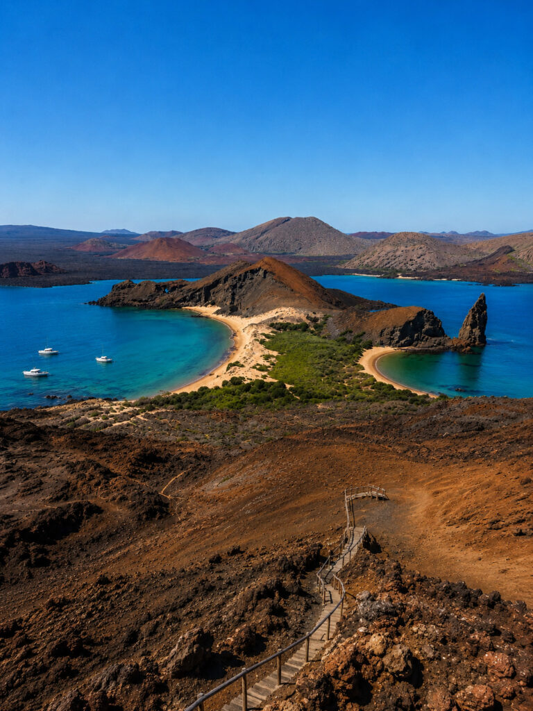
Bartolomé Island is one of the most photographed islands in the Galápagos. It’s famous for Pinnacle Rock, volcanic landscapes, and spectacular panoramic views from its summit.
Climate
The Galápagos Islands have two main seasons.
Warm & Wet Season (December–May) brings warmer temperatures, calmer seas, occasional tropical rain, and excellent conditions for snorkeling and swimming.
Cool & Dry Season (June–November) is cooler and less humid. During this time, nutrient-rich ocean currents attract more marine life, making it one of the best seasons for wildlife viewing and diving. Misty mornings, known locally as garúa, are also common.
4. Serengeti National Park
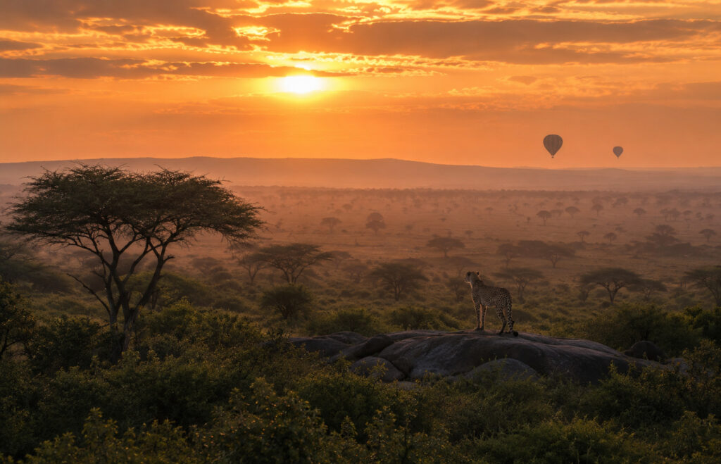
Serengeti National Park is one of the world’s most famous wildlife reserves and one of Africa’s top safari destinations. Located in northern Tanzania, it is best known for the Great Migration—the largest land-animal migration on Earth. Every year, more than 1.5 million wildebeest, along with hundreds of thousands of zebras and gazelles, travel across the plains in search of fresh grass and water.
The name Serengeti comes from the Maasai word “Siringet,” meaning “endless plains.” The name perfectly describes the park’s vast grasslands that stretch as far as the eye can see.
The park is part of the larger Serengeti Ecosystem, which covers approximately 11,600 square miles (30,000 square kilometers). It is also home to the Big Five and has one of the highest concentrations of predators anywhere in the world.
Why Is It Famous?
The Serengeti is famous for hosting the Great Migration, the largest terrestrial animal migration on Earth. It is also one of the best places in Africa to see the Big Five—lion, leopard, elephant, rhinoceros, and African buffalo. The park supports one of the continent’s largest lion populations and is known for its endless savannas, incredible wildlife, and unforgettable safari experiences.
History
For centuries, the Serengeti has been home to the Maasai people, who traditionally grazed their cattle across the open plains while living alongside the region’s wildlife.
In the early 1900s, European explorers and hunters began visiting the area. To protect its wildlife, a game reserve was established in 1929, and Serengeti National Park was officially created in 1951. In 1981, it was recognized as a UNESCO World Heritage Site because of its outstanding natural importance and incredible biodiversity.
Landscape

The Serengeti is famous for its diverse and beautiful landscapes. The park includes vast open grasslands, rolling savannas, acacia woodlands, river valleys, and rocky outcrops known as kopjes.
Kopjes are especially important because they provide shelter, shade, and excellent lookout points for predators such as lions, leopards, and cheetahs. They are also among the park’s most iconic natural features.
The Great Migration

The Great Migration is the Serengeti’s most famous natural event and one of the greatest wildlife spectacles on Earth.
Every year, more than 1.5 million wildebeest, around 200,000 zebras, and hundreds of thousands of gazelles travel in a huge circular route between Serengeti National Park in Tanzania and the Maasai Mara in Kenya. They follow seasonal rains in search of fresh grass and water.
One of the most dramatic moments of the migration happens during the river crossings, where large Nile crocodiles wait for opportunities to catch prey. These crossings are among the most exciting wildlife events in the world.
Wildlife
The Serengeti is home to more than 70 species of large mammals and over 500 bird species, making it one of the richest wildlife habitats in Africa. Visitors have the chance to see the famous Big Five, including the African lion, African leopard, African elephant, African buffalo, and the black rhinoceros, although rhinos are rare and usually found in protected areas of the park.
Besides the Big Five, the Serengeti is home to cheetahs, spotted hyenas, giraffes, hippos, crocodiles, wildebeest, zebras, gazelles, ostriches, secretary birds, and hundreds of other fascinating species.
Climate
The Serengeti has a tropical savanna climate with two main seasons.
Dry Season (June–October) brings sunny days, cooler nights, and very little rainfall. During this time, animals gather around rivers and waterholes, making it one of the best seasons for wildlife viewing and safaris.
Wet Season (November–May) transforms the plains into lush green landscapes. This is also the calving season for wildebeest, when thousands of calves are born. Many migratory birds arrive during this period, and afternoon rain showers are common.
5. Iguazú National Park
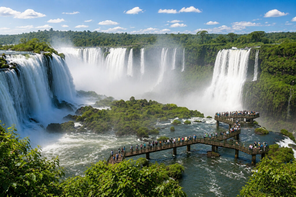
Iguazú National Park is one of the most spectacular natural destinations in the world, best known for the breathtaking Iguazú Falls—the world’s largest waterfall system. The name Iguazú comes from the Guaraní language, where “Y” (or “I”) means “water” and “Guasu” means “great.” Together, the name translates to “Great Water.”
Located in Misiones Province in northeastern Argentina, along the border with Brazil, the park protects lush subtropical rainforest, hundreds of waterfalls, and an incredible variety of wildlife.
The falls are also recognized as one of the New Seven Wonders of Nature and are widely considered among the most impressive waterfall systems on Earth.
Why Is It Famous?
Iguazú National Park is famous for protecting Iguazú Falls, the world’s largest waterfall system. The falls include around 275 individual waterfalls, with the exact number changing depending on water levels. The park is also home to the spectacular Devil’s Throat (Garganta del Diablo), the largest and most powerful waterfall in the system.
Beyond the waterfalls, the park preserves part of the endangered Atlantic Forest, which is home to jaguars, pumas, toucans, monkeys, and hundreds of bird species. Its scenic walking trails, viewing platforms, and close-up views of the waterfalls make it one of South America’s most popular natural attractions.
History
For thousands of years, the region was home to the Guaraní people, who lived in the rainforest and relied on its rivers, plants, and wildlife.
In 1542, Spanish explorer Álvar Núñez Cabeza de Vaca became one of the first Europeans to document the waterfalls. To protect this remarkable landscape, Iguazú National Park was established in 1934. In 1984, it was designated a UNESCO World Heritage Site because of its outstanding natural beauty and rich biodiversity.
How Were Iguazú Falls Formed?
Iguazú Falls were formed millions of years ago through a combination of volcanic activity and erosion. Ancient volcanic eruptions created thick layers of basalt rock, and over time, the Iguazú River gradually cut through this plateau, carving dramatic cliffs and creating the spectacular waterfall system seen today.
Iguazú Falls

Iguazú Falls consists of around 275 waterfalls, although the exact number changes with seasonal water levels. The waterfall system stretches approximately 1.7 miles (2.7 km) across and reaches heights of up to 269 feet (82 meters).
During periods of heavy rainfall, the river’s flow increases dramatically, creating an even more powerful and breathtaking display.
Devil’s Throat (Garganta del Diablo)
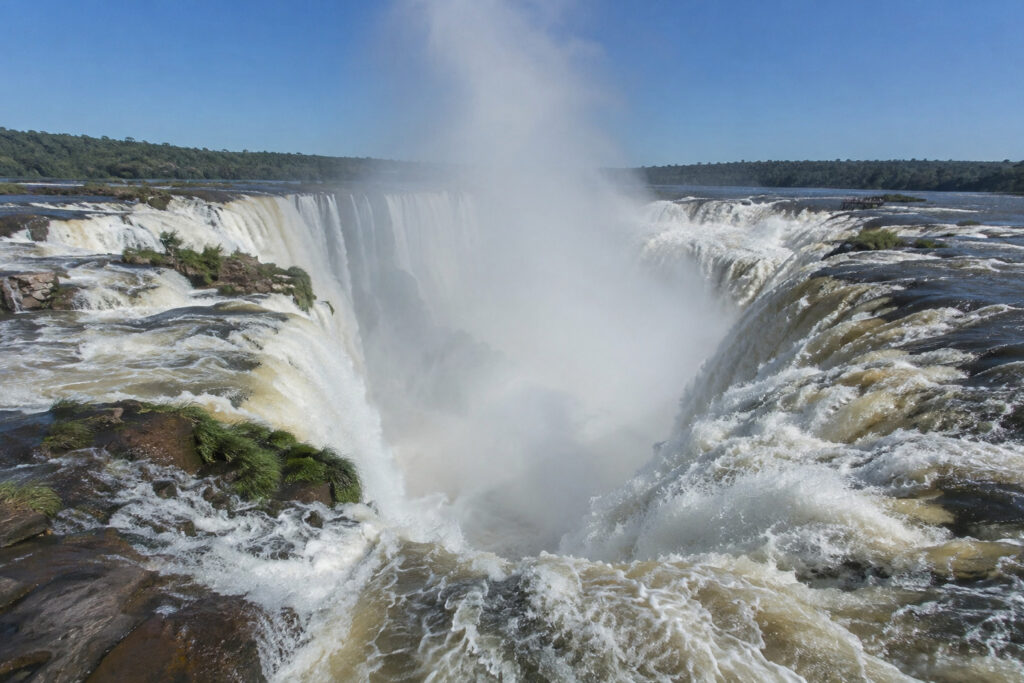
The park’s most famous attraction is Devil’s Throat (Garganta del Diablo), a massive U-shaped waterfall and the largest cascade within Iguazú Falls.
It drops about 269 feet (82 meters) into a narrow gorge, creating enormous clouds of mist and a thunderous roar that can be heard from far away. On sunny days, beautiful rainbows often appear in the spray. Visitors can experience incredible views from elevated walkways that extend over the river to the edge of the falls.
Rainforest
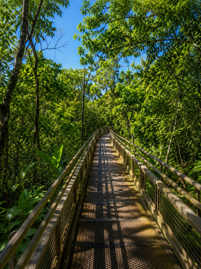
The park protects part of the Atlantic Forest, one of the world’s richest and most endangered ecosystems.
This lush rainforest is filled with dense tropical vegetation, towering trees, ferns, orchids, bromeliads, vines, and countless other plant species that provide habitat for a wide variety of wildlife.
Wildlife
Iguazú National Park is home to more than 2,000 plant species and hundreds of animal species.
Among its mammals are the jaguar, puma, ocelot, South American tapir, capuchin monkey, howler monkey, and the curious coati. Coatis are one of the animals visitors are most likely to encounter, but feeding them is strictly prohibited because it can harm both the animals and visitors.
More than 400 bird species have been recorded in the park, including toucans, parrots, hummingbirds, and the rare harpy eagle. Large flocks of swifts are famous for flying behind the waterfalls to nest safely on the cliffs.
The park is also home to reptiles such as caimans, turtles, snakes, and lizards. In addition, hundreds of colorful butterfly species can be seen throughout the rainforest, adding even more beauty to the landscape.
Climate
Iguazú National Park has a humid subtropical climate, with warm temperatures throughout the year.
Summer (December–February) is hot, humid, and rainy. This season usually brings the highest water flow, making the waterfalls even more spectacular.
Winter (June–August) is milder, with lower humidity and comfortable temperatures for hiking and sightseeing. Although rainfall is generally lighter, rain is possible at any time of the year.
6. Komodo National Park

Komodo National Park is one of the world’s most extraordinary natural destinations, located in the Lesser Sunda Islands of Indonesia. It is best known as the only place on Earth where you can see wild Komodo dragons, the world’s largest living lizards.
Beyond its famous reptiles, the park is known for its rugged volcanic islands, pink-sand beaches, crystal-clear waters, vibrant coral reefs, and some of the best diving sites in the world. It is also part of the Coral Triangle, the global center of marine biodiversity.
Why Is It Famous?
Komodo National Park is famous for being the only natural habitat of the Komodo dragon. It also protects one of the world’s richest marine ecosystems and is part of the Coral Triangle, which is home to an incredible variety of marine life. Visitors come to explore the park’s world-class snorkeling and scuba diving sites, relax on the beautiful Pink Beach, and enjoy its dramatic volcanic landscapes, tropical islands, and breathtaking viewpoints.
History
The islands have been home to local communities for centuries. To protect the endangered Komodo dragon, Komodo National Park was established in 1980. It became a UNESCO World Heritage Site in 1991 because of its outstanding natural value and was later recognized as one of the New Seven Wonders of Nature in 2011. Today, the park is carefully managed to protect both its land and marine ecosystems.
Komodo Dragons

The Komodo dragon is the world’s largest living lizard. Adults can grow up to 10 feet (3 meters) long and weigh up to 200 pounds (90 kg) in the wild.
Komodo dragons are powerful carnivores that feed on deer, wild pigs, water buffalo, birds, smaller reptiles, and carrion (dead animals). They hunt using their strong jaws, sharp serrated teeth, an excellent sense of smell, and venom that helps weaken prey by lowering blood pressure and preventing blood from clotting. Although they can sprint for short distances, they usually rely on stealth and ambush rather than long chases.
Using their forked tongues, Komodo dragons can detect the scent of carrion from several miles away.
They live in dry savannas, tropical forests, grasslands, and coastal areas. In the wild, they are found naturally only on Komodo Island, Rinca Island, Gili Motang, Gili Dasami, and parts of western Flores.
Marine Life

The waters surrounding Komodo National Park are among the richest marine ecosystems on Earth. They are home to more than 1,000 species of fish, over 250 species of reef-building corals, numerous sponge species, sea turtles, manta rays, reef sharks, dolphins, dugongs, and even seasonal visitors such as whales.
The park’s nutrient-rich currents support an incredible diversity of marine life, making it one of the world’s top destinations for snorkeling and scuba diving.
Pink Beach

One of the park’s most famous attractions is Pink Beach, one of only a handful of naturally pink beaches in the world.
Its unique color comes from white sand mixing with tiny red fragments of coralline algae and pieces of red coral. The result is a beautiful soft pink shoreline that contrasts perfectly with the turquoise waters.
Landscape

Komodo National Park offers a wide variety of stunning landscapes, including volcanic hills, dry savannas, mangrove forests, tropical beaches, rocky cliffs, coral reefs, and small islands with spectacular viewpoints.
Padar Island is especially famous for its breathtaking panoramic views overlooking three crescent-shaped bays, making it one of the park’s most photographed locations.
Climate
Komodo National Park has a tropical savanna climate with warm temperatures throughout the year.
Dry Season (April–November) is the most popular time to visit. It brings sunny weather, lower humidity, calmer seas, and excellent conditions for hiking, snorkeling, and scuba diving.
Wet Season (December–March) brings higher rainfall, greener landscapes, and rougher seas in some areas. Although rain showers are more common, the park remains beautiful year-round.
7. Ha Long Bay

Ha Long Bay is one of the world’s most breathtaking natural wonders, famous for its thousands of towering limestone islands rising from emerald-green waters. Located in northeastern Vietnam, the bay is renowned for its dramatic seascapes, hidden caves, floating fishing villages, and rich biodiversity.
The name Ha Long means “Descending Dragon” in Vietnamese. According to local legend, dragons descended from the heavens to protect Vietnam from invaders. As they flew over the sea, they spat out jewels and jade, which transformed into the thousands of limestone islands that now make up Ha Long Bay.
Covering more than 579 square miles (1,500 square kilometers), Ha Long Bay is one of Southeast Asia’s most popular tourist destinations. It is also recognized as one of the New Seven Wonders of Nature.
Why Is It Famous?
Ha Long Bay is famous for its breathtaking scenery, featuring around 1,600 limestone islands and islets rising from emerald waters. The bay is home to spectacular caves, hidden lagoons, quiet beaches, and dramatic limestone cliffs shaped over millions of years.
It is also one of Asia’s top cruise destinations, offering unforgettable overnight cruises, kayaking, and island-hopping experiences. UNESCO recognized Ha Long Bay as a World Heritage Site in 1994 for its exceptional natural beauty and expanded the designation in 2000 to include its outstanding geological and geomorphological value. The bay has also appeared in numerous films, documentaries, and travel programs around the world.
History
Ha Long Bay has been inhabited for thousands of years. Archaeological discoveries show that ancient communities lived around the bay as early as 18,000 years ago.
For generations, local people lived in floating fishing villages and depended on the bay for their livelihood. In recent years, many of these communities have been relocated to help protect the environment, although their cultural heritage remains an important part of the region’s history.
Landscape

Ha Long Bay is famous for its stunning limestone karst landscape. The bay features towering limestone islands, steep cliffs, hidden lagoons, sandy beaches, sea caves, dense tropical forests, and calm emerald-green waters.
Most of the islands are uninhabited and covered with lush vegetation, creating one of the most beautiful coastal landscapes in the world.
Famous Caves
Ha Long Bay is home to many spectacular caves that attract visitors from around the world.
A. Sung Sot Cave (Surprise Cave)

The largest and most famous cave in Ha Long Bay, Sung Sot Cave is known for its enormous chambers filled with impressive stalactites and stalagmites.
B. Thiên Cung (Heavenly Palace Cave)

This beautiful cave is famous for its colorful rock formations, dramatic lighting, and fascinating legends.
C. Đầu Gỗ (Wooden Stakes Cave)

One of the oldest and most historically significant caves in the bay, Đầu Gỗ Cave features large chambers and unique limestone formations.
D. Luồn Cave
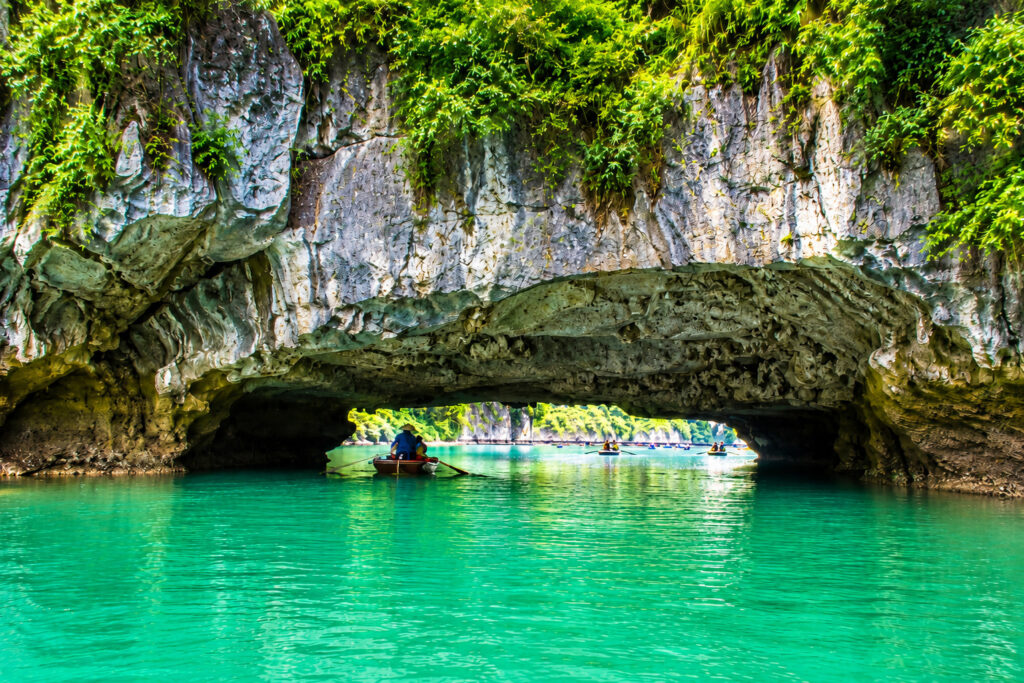
Luồn Cave can only be reached by kayak or small boat. It leads visitors into a peaceful hidden lagoon surrounded by towering limestone cliffs.
Wildlife
Ha Long Bay supports a rich variety of wildlife on both land and in the sea. Among its mammals are bats, squirrels, civets, and the critically endangered Cat Ba langur, which is found mainly on nearby Cát Bà Island.
More than 200 bird species have been recorded in the area, including the white-bellied sea eagle, kingfishers, herons, and egrets.
The bay’s waters are home to colorful coral reefs, sea turtles, hundreds of fish species, crabs, squid, mollusks, and, on occasion, dolphins.
Climate
Ha Long Bay has a humid subtropical climate, with four distinct seasons.
Spring (March–May) offers pleasant temperatures, clear skies, and excellent weather for sightseeing and cruises.
Summer (June–August) is hot and humid, with occasional heavy rain and the possibility of tropical storms.
Autumn (September–November) is one of the best times to visit, thanks to its mild weather, calm seas, and excellent visibility.
Winter (December–February) is cooler and often brings misty mornings, giving the bay a peaceful and magical atmosphere.
8. Plitvice Lakes National Park
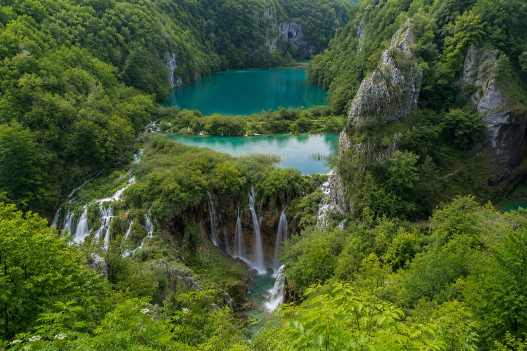
Plitvice Lakes National Park is Croatia’s oldest and largest national park, renowned for its 16 crystal-clear turquoise lakes, cascading waterfalls, lush forests, and scenic wooden boardwalks. Located in central Croatia, roughly halfway between Zagreb and Zadar, it is one of Europe’s most beautiful natural attractions and a UNESCO World Heritage Site.
The park is famous for its unique system of lakes connected by waterfalls, formed by natural travertine (limestone) barriers that continue to grow today. This ongoing natural process constantly shapes and changes the park’s stunning landscape.
Why Is It Famous?
Plitvice Lakes National Park is famous for its 16 interconnected lakes with vibrant turquoise water and more than 90 waterfalls. It is home to Veliki Slap, Croatia’s tallest waterfall, and features scenic wooden boardwalks that let visitors walk right above the lakes and waterfalls.
As one of Europe’s oldest and most visited national parks, Plitvice is celebrated for its breathtaking scenery, crystal-clear water, and unique geological formations.
History
People have lived around the Plitvice region for thousands of years. To protect its extraordinary natural beauty, the area became Croatia’s first national park in 1949.
In 1979, it was designated a UNESCO World Heritage Site because of its outstanding natural value. Today, Plitvice Lakes National Park is one of Croatia’s most popular tourist destinations, welcoming more than one million visitors in many years.
The Lakes
The park contains 16 named lakes, divided into two main groups: the Upper Lakes and the Lower Lakes.
A. Upper Lakes (Gornja jezera)
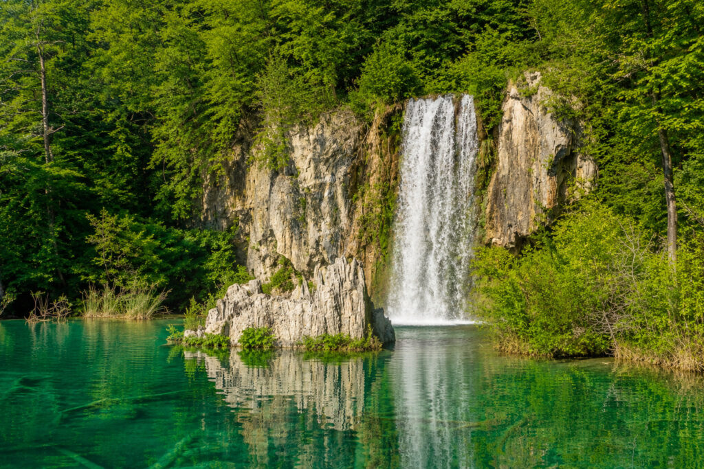
The Upper Lakes are larger, surrounded by dense forests, and connected by numerous waterfalls. They are generally quieter and offer a peaceful atmosphere.
B. Lower Lakes (Donja jezera)
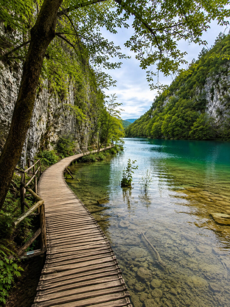
The Lower Lakes are smaller but deeper and are bordered by dramatic limestone cliffs. This section includes some of the park’s most famous viewpoints and spectacular waterfalls.
All of the lakes are connected by streams, waterfalls, and natural travertine barriers, creating one continuous chain of flowing water.
Veliki Slap (The Great Waterfall)

The park’s tallest waterfall is Veliki Slap, which means “Great Waterfall.”
It stands about 256 feet (78 meters) tall and is fed by the Plitvica Stream. As Croatia’s highest waterfall, it is one of the park’s most iconic landmarks and among the country’s most photographed natural attractions.
Water Color
One of Plitvice Lakes National Park’s most remarkable features is the constantly changing color of its lakes.
Depending on the sunlight, mineral content, water depth, and viewing angle, the water can appear emerald green, turquoise, deep blue, or even light gray. This ever-changing display is one of the park’s most memorable sights.
Wildlife
Plitvice Lakes National Park protects one of Croatia’s richest wildlife habitats.
The park is home to brown bears, gray wolves, Eurasian lynx, red deer, wild boars, foxes, and European otters. Although these animals live within the park, they are rarely seen because they naturally avoid humans.
More than 160 bird species have also been recorded, making Plitvice a popular destination for birdwatchers and nature lovers.
Climate
Plitvice Lakes National Park has a mountain continental climate, with each season offering a different experience.
Spring (March–May) brings powerful waterfalls fed by melting snow, fresh greenery, and mild temperatures.
Summer (June–August) offers warm weather and long days, making it the busiest season for hiking and sightseeing.
Autumn (September–November) transforms the forests into brilliant shades of red, orange, and yellow, creating spectacular scenery for photography.
Winter (December–February) blankets the park in snow, and many waterfalls partially freeze, creating a peaceful and magical landscape.
9. Sagarmatha National Park
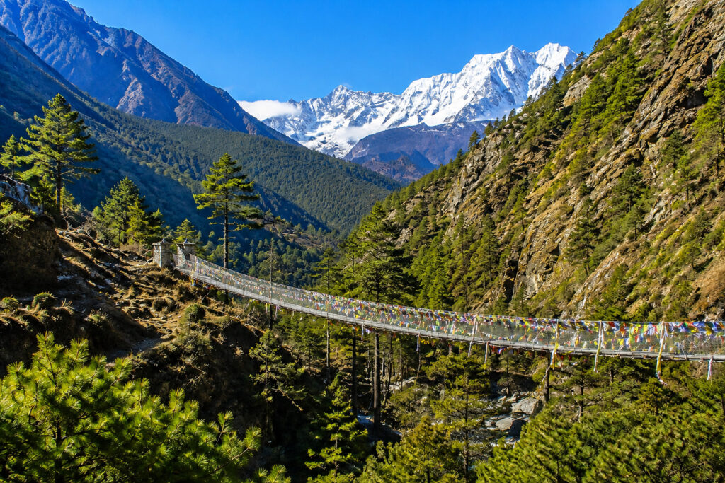
Sagarmatha National Park is one of the world’s most spectacular mountain parks, located in the Himalayas of northeastern Nepal, along the border with the Tibet Autonomous Region of China. It is home to Mount Everest, the highest mountain on Earth, standing at 29,031.7 feet (8,848.86 meters) above sea level.
The park is famous for its towering Himalayan peaks, deep valleys, glaciers, Sherpa culture, rare wildlife, and some of the world’s most challenging trekking routes. Every year, thousands of trekkers and mountaineers visit the park to experience its breathtaking scenery and world-famous trails.
Sagarmatha is the Nepali name for Mount Everest, meaning “Forehead of the Sky.” In Tibetan, the mountain is called Chomolungma, which means “Goddess Mother of the World.”
Why Is It Famous?
Sagarmatha National Park is famous for being home to Mount Everest, the highest mountain on Earth. The park also contains several peaks rising above 22,965 feet (7,000 meters) and is home to the world-famous Everest Base Camp Trek, one of the most iconic hiking routes in the world.
Besides its incredible mountains, the park protects unique Himalayan ecosystems and preserves the culture and traditions of the Sherpa people, making it one of the world’s premier destinations for trekking, mountaineering, and adventure tourism.
History
The Khumbu region has been home to the Sherpa people for centuries. They are renowned for their exceptional mountaineering skills and rich Buddhist traditions.
To protect this unique mountain environment, Sagarmatha National Park was established in 1976. It became a UNESCO World Heritage Site in 1979 because of its outstanding natural beauty and ecological importance. Today, it remains one of Nepal’s most important protected areas.
Mount Everest

The park’s most famous landmark is Mount Everest, which rises to 29,031.7 feet (8,848.86 meters) above sea level.
On May 29, 1953, Sir Edmund Hillary and Tenzing Norgay became the first climbers confirmed to reach the summit. Since then, hundreds of climbers have attempted to scale Everest during each climbing season.
One fascinating fact is that Mount Everest continues to grow by a few millimeters every year as the Indian and Eurasian tectonic plates slowly collide beneath the Himalayas.
Other Famous Peaks
Sagarmatha National Park is also home to several spectacular Himalayan mountains, including Lhotse (27,940 feet / 8,516 meters), Nuptse (25,791 feet / 7,861 meters), Ama Dablam (22,349 feet / 6,812 meters), and Pumori (23,494 feet / 7,161 meters).
Nearby Cho Oyu (26,864 feet / 8,188 meters) lies just outside the park boundary and is the world’s sixth-highest mountain.
Glaciers

The park contains several impressive glaciers, including the Khumbu Glacier, Imja Glacier, and the nearby Ngozumpa Glacier, the longest glacier in the Himalayas.
One of the park’s most famous features is the Khumbu Icefall, one of the most dangerous sections of the Everest climbing route because of its constantly shifting ice towers and deep crevasses.
Wildlife
Despite its harsh alpine environment, Sagarmatha National Park supports a surprising variety of wildlife.
Among its mammals are the snow leopard (very rare), Himalayan tahr, musk deer, Himalayan black bear, and Himalayan goral. Although these animals are difficult to spot, they are specially adapted to survive in the rugged mountain landscape.
The park is also home to more than 200 bird species, including the colorful Himalayan monal (Nepal’s national bird), blood pheasant, and snow pigeon.
Sherpa Culture

The Sherpa people have lived in the Khumbu region for generations and play an important role in the history of Himalayan mountaineering.
Visitors can experience traditional Sherpa villages, ancient Buddhist monasteries, colorful prayer flags, carved mani stones, warm local hospitality, and authentic Sherpa cuisine.
One of the park’s most important spiritual landmarks is Tengboche Monastery, the largest and most famous monastery in the Everest region.
Climate
Sagarmatha National Park has an alpine climate, with weather changing dramatically throughout the year.
Spring (March–May) brings mild temperatures, blooming rhododendrons, and excellent trekking conditions.
Summer (June–August) is the monsoon season, bringing heavy rainfall, cloudy skies, and reduced mountain visibility.
Autumn (September–November) is the best time to visit, with clear skies, stable weather, and spectacular mountain views.
Winter (December–February) is extremely cold, especially at higher elevations, with heavy snowfall and far fewer visitors.
10. Yosemite National Park
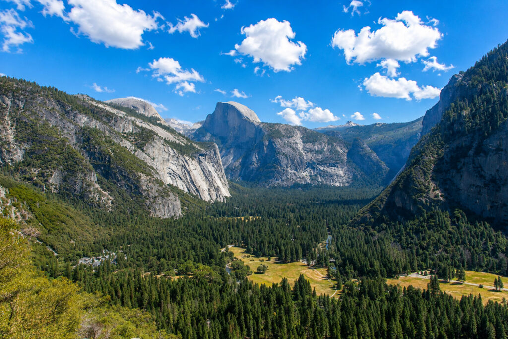
Yosemite National Park is one of the world’s most iconic national parks, renowned for its towering granite cliffs, giant sequoia trees, spectacular waterfalls, alpine meadows, and breathtaking mountain scenery. Located in California’s Sierra Nevada mountains, Yosemite attracts millions of visitors every year and is considered one of the greatest natural treasures in the United States.
The park is especially famous for landmarks such as Half Dome, El Capitan, and Yosemite Falls, as well as its important role in the history of conservation.
Why Is It Famous?
Yosemite National Park is famous for its towering granite cliffs, ancient giant sequoia groves, and some of the most spectacular scenery in North America. It is home to Yosemite Falls, one of the continent’s tallest waterfalls, and El Capitan, one of the world’s most famous rock-climbing destinations.
The park also offers outstanding hiking trails, breathtaking viewpoints, and diverse wildlife. Its protection and the work of conservationist John Muir played a major role in the development of the modern conservation movement and the U.S. National Park System.
History
For thousands of years, Yosemite Valley was home to Indigenous peoples, including the Ahwahneechee, who lived in and cared for the region.
In 1864, during the American Civil War, President Abraham Lincoln signed the Yosemite Grant, protecting Yosemite Valley and the Mariposa Grove of Giant Sequoias. It was the first time the U.S. government protected land specifically for public enjoyment and conservation.
Yosemite officially became a national park in 1890, and the efforts of conservationist John Muir helped ensure its long-term protection while influencing the creation of the U.S. National Park System.
In 1984, Yosemite National Park was designated a UNESCO World Heritage Site because of its remarkable granite landscapes, glacial landforms, giant sequoia groves, and exceptional biodiversity.
Yosemite Valley
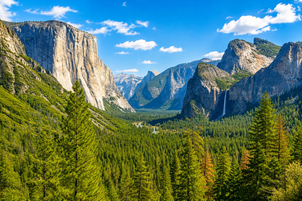
Yosemite Valley is the park’s most visited area and the heart of Yosemite National Park.
The valley stretches about 7 miles (11 kilometers) long, is up to 1 mile (1.6 kilometers) wide, and is surrounded by towering granite cliffs rising more than 3,000 feet (900 meters) above the valley floor.
Famous Landmarks
A. Half Dome
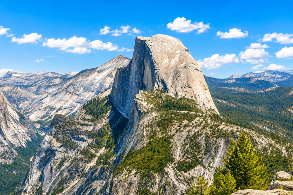
Half Dome is one of Yosemite’s most recognizable landmarks. Rising to about 8,839 feet (2,694 meters) above sea level, it is famous for its unique shape and challenging cable route to the summit. A permit is required to hike the cables during the main climbing season.
B. El Capitan

El Capitan is one of the world’s largest exposed granite monoliths, rising about 3,000 feet (914 meters) from its base. It is considered one of the world’s premier rock-climbing destinations and attracts elite climbers from around the globe.
C. Glacier Point

Glacier Point offers one of Yosemite’s most spectacular panoramic views, overlooking Yosemite Valley, Half Dome, Yosemite Falls, and the surrounding Sierra Nevada mountains.
D. Bridalveil Fall

Bridalveil Fall is one of the first waterfalls visitors see when entering Yosemite Valley. It plunges about 620 feet (188 meters) and often creates beautiful rainbows in its mist.
Waterfalls
Yosemite National Park is home to many spectacular waterfalls, especially during spring when melting snow feeds the rivers.
A. Yosemite Falls

With a total height of about 2,425 feet (739 meters), Yosemite Falls is one of the tallest waterfalls in North America. It is at its most powerful during the spring snowmelt.
B. Vernal Fall

Vernal Fall drops about 317 feet (97 meters) and can be reached via the famous Mist Trail, where visitors often experience refreshing spray from the waterfall.
C. Nevada Fall
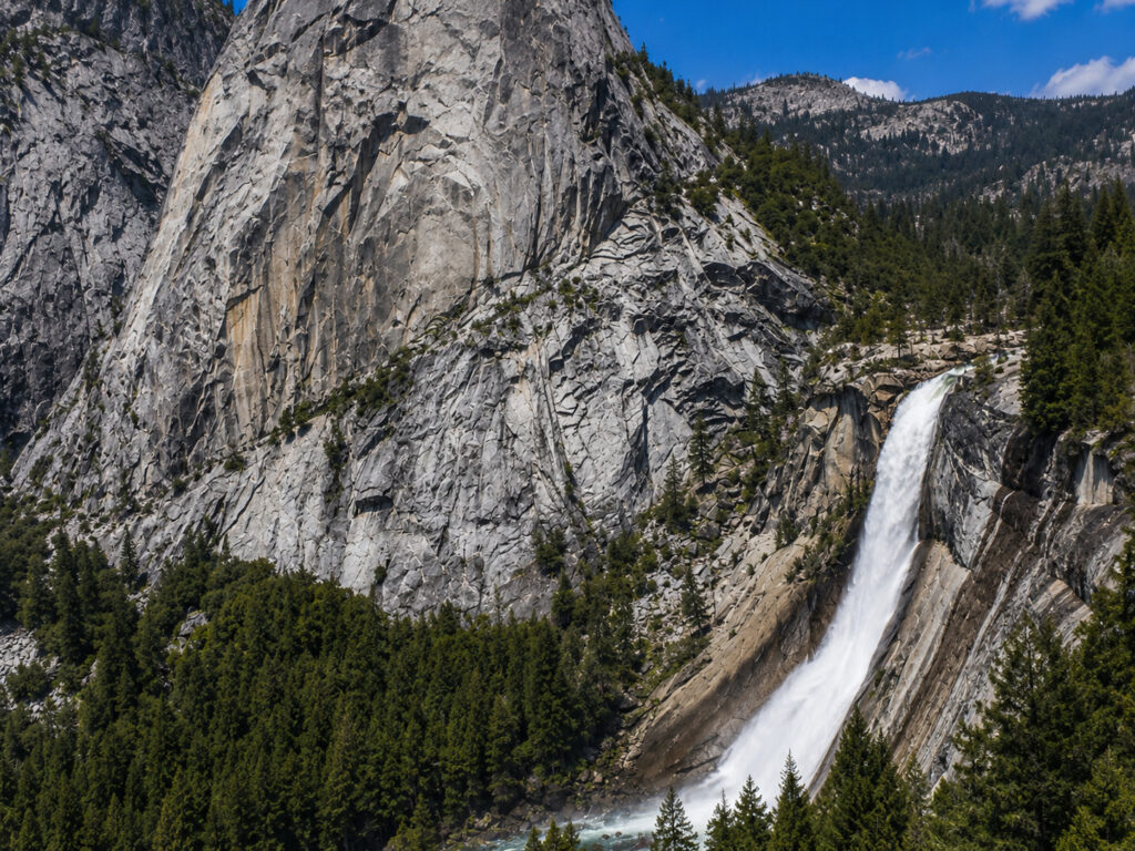
Located upstream from Vernal Fall, Nevada Fall plunges approximately 594 feet (181 meters) and is another highlight of the Mist Trail.
D. Ribbon Fall

At about 1,612 feet (491 meters), Ribbon Fall is one of North America’s tallest single-drop waterfalls. It usually flows only during spring when snowmelt is at its peak.
Giant Sequoias

Yosemite protects several groves of giant sequoias, the largest trees on Earth by volume.
The most famous is Mariposa Grove, which is home to more than 500 mature giant sequoias. Some of these incredible trees are over 2,000 years old, reach heights of more than 300 feet (90 meters), and have trunks wide enough to dwarf cars and buildings.
Wildlife
Yosemite National Park is home to hundreds of wildlife species.
Common mammals include the American black bear, mule deer, bobcat, coyote, gray fox, yellow-bellied marmot, and the elusive mountain lion, although sightings are extremely rare.
The park is also home to more than 260 bird species, including the Steller’s jay, peregrine falcon, great gray owl, and mountain chickadee.
Climate
Yosemite’s climate varies depending on elevation, with each season offering a unique experience.
Spring (April–June) brings powerful waterfalls, blooming wildflowers, and mild temperatures, making it one of the best times to visit.
Summer (July–August) offers warm days and excellent hiking conditions, although it is also the busiest tourist season.
Autumn (September–October) features cooler weather, beautiful fall colors, and fewer crowds.
Winter (November–March) blankets the higher elevations in snow, creating excellent conditions for snowshoeing and cross-country skiing. Some park roads and high-elevation areas close during the winter because of heavy snowfall.
11. Swiss Alps Jungfrau-Aletsch
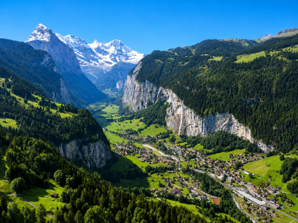
Swiss Alps Jungfrau-Aletsch is one of the world’s most spectacular mountain landscapes and the first natural site in the Alps to be designated a UNESCO World Heritage Site. Located in the Bernese Alps of southern Switzerland, the region is famous for its snow-covered peaks, massive glaciers, picturesque valleys, alpine meadows, and breathtaking scenery.
The area is home to the Aletsch Glacier, the largest glacier in the Alps, as well as iconic mountains such as the Eiger, Mönch, and Jungfrau. Its dramatic landscapes make it one of Switzerland’s most famous natural attractions.
Why Is It Famous?
The Swiss Alps Jungfrau-Aletsch region is famous for being home to the largest glacier in the Alps and some of Switzerland’s most iconic mountains. It offers world-class hiking, mountaineering, skiing, and unforgettable alpine scenery.
The region also includes Jungfraujoch, often called the “Top of Europe,” and protects pristine alpine ecosystems filled with glaciers, forests, meadows, and wildlife. It became the first natural site in the Alps to receive UNESCO World Heritage status.
History
The region has attracted explorers, scientists, and mountaineers since the 18th century. During the 1800s, many of its famous peaks were climbed for the first time, helping establish the Alps as one of the world’s greatest mountaineering destinations.
A major milestone came with the completion of the Jungfrau Railway in 1912, making the high mountains more accessible to visitors.
The area was inscribed as a UNESCO World Heritage Site in 2001 under the name Jungfrau-Aletsch-Bietschhorn. In 2007, the protected area was expanded and renamed Swiss Alps Jungfrau-Aletsch.
Major Mountains
A. Jungfrau
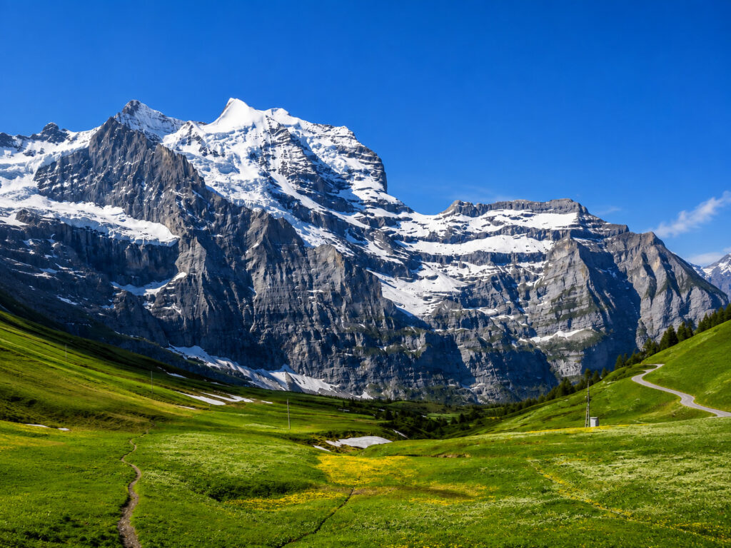
Jungfrau rises to about 13,642 feet (4,158 meters) above sea level. Its name means “Maiden,” and it is one of Switzerland’s most famous and recognizable peaks.
B. Eiger

Standing about 13,015 feet (3,967 meters) high, the Eiger is famous for its legendary North Face, one of the world’s most challenging and celebrated rock-climbing routes.
C. Mönch

Mönch reaches 13,474 feet (4,107 meters) and stands between the Eiger and Jungfrau, completing the region’s famous trio of peaks.
D. Finsteraarhorn
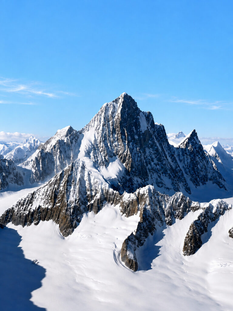
At 14,022 feet (4,274 meters), Finsteraarhorn is the highest mountain within the UNESCO World Heritage Site.
Aletsch Glacier

The Aletsch Glacier is the region’s greatest natural wonder and the largest glacier in the Alps.
It stretches for about 14 miles (23 kilometers), with ice reaching more than 2,625 feet (800 meters) thick in some places. Fed by snow from the surrounding mountains, the glacier continues to shape the landscape through its slow movement and erosion.
Jungfraujoch – Top of Europe

One of the region’s most famous attractions is Jungfraujoch, often called the “Top of Europe.”
It is home to Europe’s highest railway station, located at 11,332 feet (3,454 meters) above sea level. Visitors can also explore the Sphinx Observatory, walk through the Ice Palace, and enjoy spectacular panoramic views of the Aletsch Glacier.
The historic Jungfrau Railway carries visitors through tunnels carved inside the mountains, making the journey just as memorable as the destination.
Valleys and Landscapes
The region is filled with spectacular alpine scenery, including deep U-shaped valleys, flower-filled meadows, waterfalls, forests, snowfields, glacial lakes, and traditional Swiss villages.
One of its most famous areas is Lauterbrunnen Valley, renowned for its towering cliffs and more than 70 waterfalls, making it one of the most beautiful valleys in the Alps.
Wildlife
The Swiss Alps Jungfrau-Aletsch region supports a rich variety of alpine wildlife.
Its mammals include the Alpine ibex, chamois, red deer, Alpine marmot, red fox, and mountain hare.
More than 120 bird species have been recorded, including the golden eagle, Alpine chough, bearded vulture, and snow finch, all of which are well adapted to life in the high mountains.
Climate
The region has an alpine climate, with each season offering a different experience.
Summer (June–September) brings mild temperatures, green alpine meadows, and excellent conditions for hiking and sightseeing.
Autumn (September–October) offers cool weather, golden forests, and fewer visitors, making it a peaceful time to explore.
Winter (December–March) transforms the mountains into a snowy paradise, attracting skiers, snowboarders, and winter sports enthusiasts from around the world.
Spring (April–May) brings melting snow, blooming alpine flowers, and rushing waterfalls, creating beautiful mountain scenery.
12. Lake Baikal

Lake Baikal is the world’s deepest, oldest, and largest freshwater lake by volume, making it one of Earth’s most extraordinary natural wonders. Located in southern Siberia, Russia, it contains approximately 20% of the world’s unfrozen surface freshwater and is home to thousands of unique species found nowhere else on the planet.
Often called the “Pearl of Siberia” or the “Galápagos of Russia,” Lake Baikal is renowned for its crystal-clear water, spectacular mountain scenery, ancient geological history, and exceptional biodiversity.
Why Is It Famous?
Lake Baikal is famous for being the deepest lake in the world and the oldest freshwater lake, with an estimated age of 25–30 million years. It holds around 20% of the world’s unfrozen surface freshwater and supports more than 3,500 species of plants and animals, many of which are found nowhere else on Earth.
The lake is also known for its incredibly clear water, where visibility can reach 130 feet (40 meters) in some seasons. During winter, it freezes into a breathtaking landscape of transparent blue ice. Because of its outstanding geological history, unique ecosystems, remarkable biodiversity, and enormous freshwater resources, Lake Baikal was designated a UNESCO World Heritage Site in 1996.
Why Is It So Deep?
Lake Baikal is unusually deep because it lies within an active continental rift zone, where the Earth’s crust is slowly pulling apart.
Unlike many lakes that gradually become shallower as sediment builds up, tectonic activity continues to deepen Baikal over time. Scientists believe that beneath the accumulated sediments lies an even deeper rock basin, making it one of the most geologically fascinating lakes on Earth.
Water
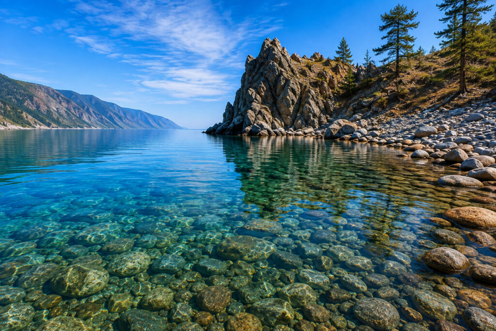
Lake Baikal contains some of the clearest freshwater in the world.
Visibility can reach up to 130 feet (40 meters) under ideal conditions, thanks to the lake’s low mineral content and tiny microorganisms that naturally filter the water. Even at great depths, the water contains unusually high levels of oxygen, supporting a rich variety of aquatic life.
More than 330 rivers and streams flow into Lake Baikal, while the Angara River is the only river that flows out of the lake.
Ice in Winter
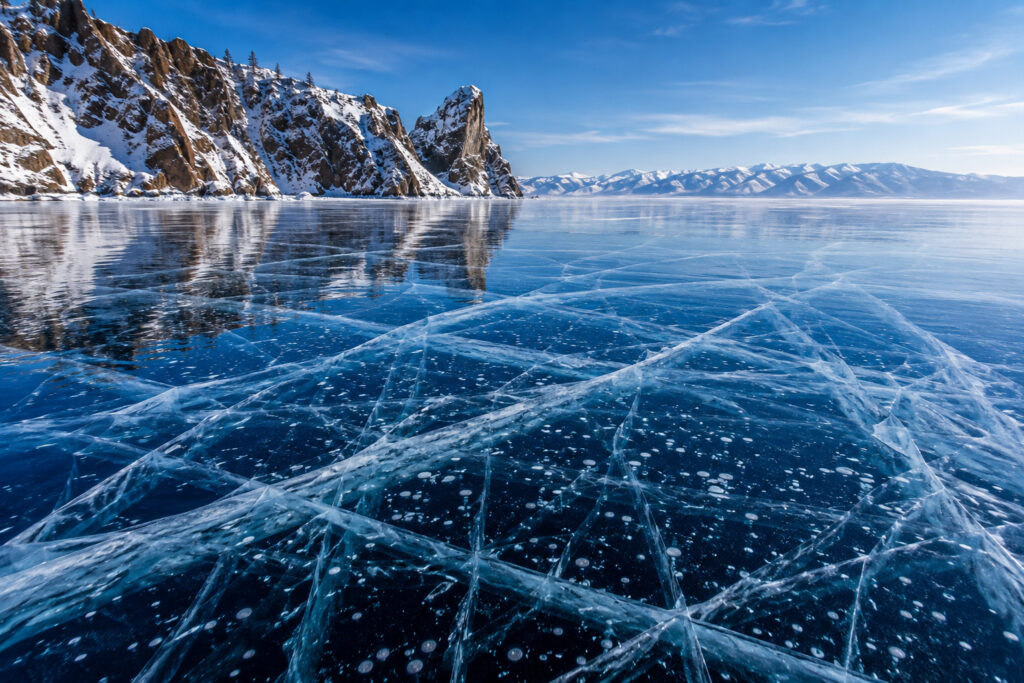
During winter, Lake Baikal transforms into one of the world’s most spectacular frozen landscapes.
Its ice is famous for its remarkable transparency, allowing visitors to see several meters below the surface. In many areas, the ice grows to more than 3 feet (1 meter) thick and often displays stunning shades of blue.
Another unique feature is the frozen methane bubbles trapped beneath the ice, creating beautiful natural patterns. Long cracks regularly appear across the surface as the ice expands and contracts, helping relieve pressure. The lake usually remains frozen from January to May.
Islands
Lake Baikal contains more than 25 islands, each with its own unique landscapes and cultural significance.
A. Olkhon Island
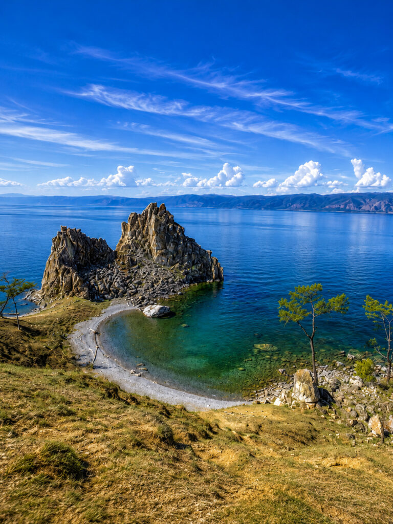
Olkhon Island is the largest island in Lake Baikal. It is famous for its dramatic cliffs, sacred cultural sites, traditional Buryat heritage, and spectacular viewpoints overlooking the lake.
Wildlife
Lake Baikal supports one of the richest freshwater ecosystems on Earth.
A. Baikal Seal (Nerpa)
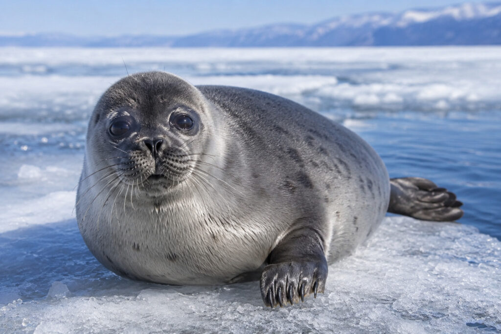
The Baikal seal, also known as the Nerpa, is the world’s only freshwater seal. Found nowhere else on Earth, it has become one of Lake Baikal’s most famous and beloved animals.
More than 60 fish species live in the lake, including the Baikal omul, golomyanka (oilfish), Siberian grayling, and sturgeon. Many of these species are endemic and cannot be found anywhere else.
The lake also supports more than 300 bird species, including the white-tailed eagle, osprey, swans, ducks, and herons, making it an excellent destination for birdwatching.
Climate
Lake Baikal has a continental climate, although the enormous lake helps moderate temperatures in nearby areas.
Summer (June–August) brings pleasant weather, making it the ideal season for hiking, boating, and enjoying the lake’s exceptionally clear water.
Autumn (September–October) offers cooler temperatures and colorful forests surrounding the lake.
Winter (November–March) is extremely cold, transforming Baikal into a spectacular frozen landscape famous for its transparent ice and winter activities.
Spring (April–May) marks the gradual melting of the ice, and wildlife becomes increasingly active as the region warms.
13. Rock Islands Southern Lagoon

Rock Islands Southern Lagoon is one of the world’s most spectacular tropical marine landscapes, located in the Pacific island nation of Palau. The site is famous for its hundreds of mushroom-shaped limestone islands, crystal-clear turquoise lagoons, coral reefs, hidden beaches, marine lakes, and extraordinary biodiversity.
The area is best known for Jellyfish Lake, where visitors once had the rare opportunity to swim among millions of nearly harmless jellyfish. It is also one of the world’s premier destinations for snorkeling, scuba diving, and marine conservation.
Why Is It Famous?
The Rock Islands Southern Lagoon is famous for its more than 400 uninhabited limestone islands, crystal-clear lagoons, white-sand beaches, and some of the richest coral reef ecosystems on Earth.
The site is home to the world-famous Jellyfish Lake, offers exceptional scuba diving and snorkeling, and protects an incredible variety of marine life. Its unique combination of tropical islands, marine lakes, coral reefs, and pristine waters makes it one of the Pacific’s most remarkable natural destinations.
History
The Rock Islands have been shaped by natural processes over millions of years and have also been used by the people of Palau for centuries.
Archaeological evidence shows that some of the islands were inhabited thousands of years ago. To protect this extraordinary marine ecosystem, the Rock Islands Southern Lagoon was designated a UNESCO World Heritage Site in 2012. Today, the area is carefully managed to balance tourism with long-term conservation.
Landscape

The landscape is made up of hundreds of limestone islands surrounded by hidden lagoons, mangrove forests, white-sand beaches, coral reefs, sea caves, blue channels, and marine lakes.
Many of the islands are completely uninhabited and covered with dense tropical vegetation, creating one of the most beautiful island landscapes in the world.
Jellyfish Lake
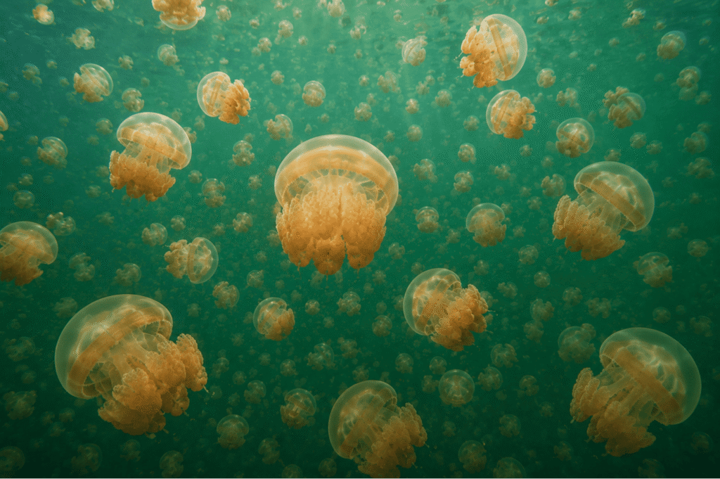
One of the site’s most famous attractions is Jellyfish Lake, a unique marine lake connected to the ocean through small cracks in the surrounding limestone.
For many years, millions of golden jellyfish and moon jellyfish migrated across the lake each day following the sunlight. Having evolved in isolation, these jellyfish lost much of their ability to sting humans, making the lake famous around the world.
However, jellyfish populations naturally fluctuate. After significant declines caused by changing environmental conditions, the lake was temporarily closed and has experienced limited reopenings to support ecosystem recovery. Visitor access depends on current conservation regulations, and swimming is only permitted when conditions allow.
Marine Life
The lagoon protects one of the richest marine ecosystems on Earth.
A. Coral Reefs
The area contains more than 400 species of hard corals, along with soft corals, sea fans, and giant clams, creating vibrant underwater habitats for countless marine animals.
B. Fish
More than 1,300 fish species have been recorded, including clownfish, butterflyfish, parrotfish, Napoleon wrasse, and barracuda. The surrounding waters also support sea turtles, reef sharks, manta rays, and many other marine creatures.
Wildlife on Land
Although most of the area’s wildlife is found underwater, the islands also support a variety of land animals.
Mammals include fruit bats (flying foxes), while birds such as the Micronesian megapode, white tern, kingfishers, and numerous seabirds nest on the islands.
Reptiles include geckos, skinks, and sea snakes, while invertebrates such as coconut crabs and hermit crabs are commonly found throughout the islands.
Climate
The Rock Islands Southern Lagoon has a tropical rainforest climate, with warm temperatures throughout the year averaging around 81–86°F (27–30°C).
Dry Season (December–April) brings more sunshine, calmer seas, and excellent conditions for snorkeling, scuba diving, and island hopping.
Wet Season (May–November) is warmer and wetter, with frequent tropical showers that keep the islands lush and green. Even during this season, rain often comes in short bursts, allowing visitors to enjoy outdoor activities throughout the year.
14. Mount Kenya National Park

Mount Kenya National Park is one of Africa’s most spectacular mountain parks, centered around Mount Kenya, the second-highest mountain in Africa after Mount Kilimanjaro. Located in central Kenya, the park is famous for its snow-capped peaks, glaciers, alpine lakes, bamboo forests, and remarkable wildlife.
Mount Kenya is a long-extinct volcano and one of Kenya’s most important sources of freshwater. Its dramatic landscapes, diverse ecosystems, and outstanding natural beauty earned the park recognition as a UNESCO World Heritage Site.
Why Is It Famous?
Mount Kenya National Park is famous for protecting Mount Kenya, Africa’s second-highest mountain, and its spectacular landscapes of glaciers, alpine lakes, rugged peaks, and deep valleys.
The park is also known for its unique high-altitude plants, diverse wildlife, and excellent trekking and climbing routes. In addition, Mount Kenya serves as one of Kenya’s most important water catchments, supplying rivers that support millions of people, agriculture, and wildlife.
History
For centuries, Mount Kenya has been regarded as a sacred mountain by local communities, especially the Kikuyu, Embu, and Meru peoples.
To protect its forests and wildlife, Mount Kenya National Park was established in 1949. It became a UNESCO World Heritage Site in 1997, and in 2013, the World Heritage Site was expanded to include the surrounding forest reserve, providing even greater protection for the mountain’s ecosystems.
The Peaks

Mount Kenya has three main peaks.
A. Batian
Batian is the highest peak, rising to about 17,057 feet (5,199 meters) above sea level. Reaching the summit requires technical rock climbing and mountaineering experience.
B. Nelion
At about 17,021 feet (5,188 meters), Nelion is the mountain’s second-highest peak. Like Batian, it can only be reached through technical climbing.
C. Point Lenana
Point Lenana stands at approximately 16,355 feet (4,985 meters) and is the mountain’s most accessible summit. It is the most popular destination for trekkers because it can be reached without technical climbing.
Glaciers and Lakes
Although they are shrinking because of climate change, Mount Kenya still has several glaciers, including Lewis Glacier, Gregory Glacier, and Darwin Glacier.
The park also contains beautiful alpine lakes such as Lake Michaelson, Lake Ellis, and Lake Alice. Fed by snowmelt and rainfall, these lakes add to the mountain’s breathtaking scenery and provide important freshwater habitats.
Unique Vegetation
Mount Kenya is famous for its remarkable plant life, which changes dramatically with elevation.
The lower slopes are covered with bamboo forests, cedar forests, olive trees, and podocarpus forests.
Higher up, the Afro-alpine zone features unusual plants such as giant lobelias, giant groundsels, heather, alpine grasses, and colorful wildflowers. These remarkable plants are specially adapted to freezing nights and warm, sunny days.
Wildlife
Mount Kenya National Park supports a rich variety of wildlife.
Mammals found in the park include the African elephant, Cape buffalo, leopard, bushbuck, giant forest hog, black-and-white colobus monkey, and spotted hyena.
More than 130 bird species have been recorded, including Verreaux’s eagle, Hartlaub’s turaco, Jackson’s francolin, several species of sunbirds, and the striking scarlet-tufted malachite sunbird.
Climate
Mount Kenya’s climate changes dramatically with elevation rather than by season.
The lower elevations are generally warm, humid, and covered with dense forests.
The mid-elevations experience cooler temperatures and frequent rainfall, supporting lush vegetation.
The highest elevations remain cold throughout the year, with freezing nights, occasional snowfall, and permanent ice on the highest peaks, although the glaciers continue to shrink because of climate change.
15. Kaziranga National Park
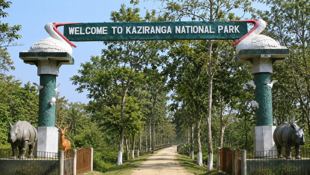
Kaziranga National Park is one of India’s most celebrated wildlife sanctuaries and a global conservation success story. Located in the northeastern state of Assam, it is best known for protecting the world’s largest population of the greater one-horned rhinoceros.
The park is also home to Bengal tigers, Asian elephants, wild water buffalo, and hundreds of bird species. Its vast floodplains, tall elephant grass, wetlands, and forests make it one of Asia’s richest biodiversity hotspots.
Why Is It Famous?
Kaziranga National Park is famous for being home to about two-thirds of the world’s wild greater one-horned rhinoceroses. It also has one of the highest densities of Bengal tigers among protected areas and is one of the few places where visitors may see the Big Five of Kaziranga: the greater one-horned rhinoceros, Bengal tiger, Asian elephant, wild water buffalo, and eastern swamp deer.
The park’s rich wetlands and grasslands support an incredible variety of wildlife, making Kaziranga one of India’s greatest conservation success stories and a paradise for nature lovers and wildlife photographers.
History
Kaziranga’s conservation story began in 1904, when Mary Curzon, the wife of the Viceroy of India, visited the area and became concerned about the declining number of greater one-horned rhinoceroses.
Following her recommendation, the area was declared a Reserved Forest in 1905. It later became a Game Sanctuary in 1916, was renamed a Wildlife Sanctuary in 1950, and was officially designated a National Park in 1974.
In 1985, Kaziranga National Park was recognized as a UNESCO World Heritage Site for its exceptional biodiversity and outstanding conservation efforts.
Landscape
Kaziranga’s landscape is made up of vast elephant grasslands, floodplain wetlands, marshes, tropical forests, sandbars, and numerous rivers and streams.
Annual flooding from the Brahmaputra River plays a vital role in maintaining the park’s ecosystems by replenishing the soil, creating new wetlands, and supporting its rich biodiversity.
Wildlife
Kaziranga National Park is one of India’s richest wildlife habitats.
Its mammals include the greater one-horned rhinoceros, Bengal tiger, Asian elephant, wild water buffalo, eastern swamp deer, leopard, sloth bear, wild boar, and hog deer.
The park is also a paradise for birdwatchers, with more than 500 bird species recorded. Notable birds include the great hornbill, Pallas’s fish eagle, lesser adjutant, Bengal florican, bar-headed goose, pelicans, and numerous species of kingfishers. Because of its exceptional birdlife, Kaziranga has been recognized as an Important Bird Area (IBA).
Its reptiles include the king cobra, Indian python, water monitor lizard, mugger crocodile, and the endangered Assam roofed turtle.
Climate
Kaziranga has a tropical monsoon climate, with three distinct seasons.
Winter (November–February) brings cool, dry weather and is widely considered the best time for wildlife viewing.
Summer (March–May) is warm and increasingly humid, but wildlife is still active around water sources.
Monsoon (June–September) brings heavy rainfall and seasonal flooding from the Brahmaputra River. During this period, much of the park is usually closed to visitors, allowing wildlife to move to higher ground while the floodplains are naturally renewed.
16. Gros Morne National Park
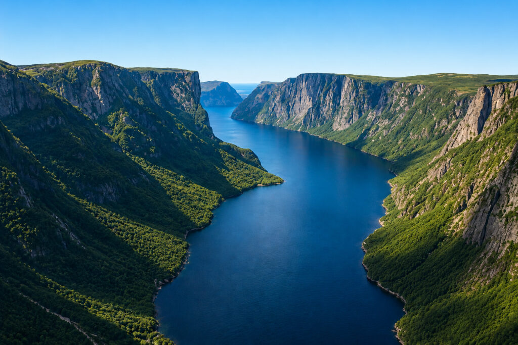
Gros Morne National Park is one of Canada’s most spectacular natural landscapes, located on the west coast of the island of Newfoundland. The park is famous for its dramatic fjords, towering cliffs, ancient mountains, pristine lakes, rugged coastline, and the unique Tablelands, where rocks from the Earth’s mantle are exposed at the surface.
The name Gros Morne comes from the French language and roughly means “large solitary mountain” or “great gloomy mountain.” It refers to the park’s highest peak, Gros Morne Mountain.
Its extraordinary geology provides some of the world’s clearest evidence of plate tectonics, making it one of the most scientifically significant national parks on Earth.
Why Is It Famous?
Gros Morne National Park is famous for exposing rocks from the Earth’s mantle at the surface, providing some of the world’s best evidence of plate tectonics in action.
The park also features spectacular glacier-carved fjords, rugged mountains, scenic coastal landscapes, and world-class hiking trails. Its exceptional geological importance and natural beauty earned it recognition as one of Canada’s UNESCO World Heritage Sites.
History
For thousands of years, Indigenous peoples, including the Mi’kmaq, Innu, and earlier cultures, lived in and traveled through this region, relying on its rich natural resources.
To protect its remarkable landscapes and unique geology, Gros Morne National Park was established in 1973. In 1987, it was designated a UNESCO World Heritage Site because of its outstanding geological significance and its exceptional evidence of continental drift and plate tectonics.
The Tablelands
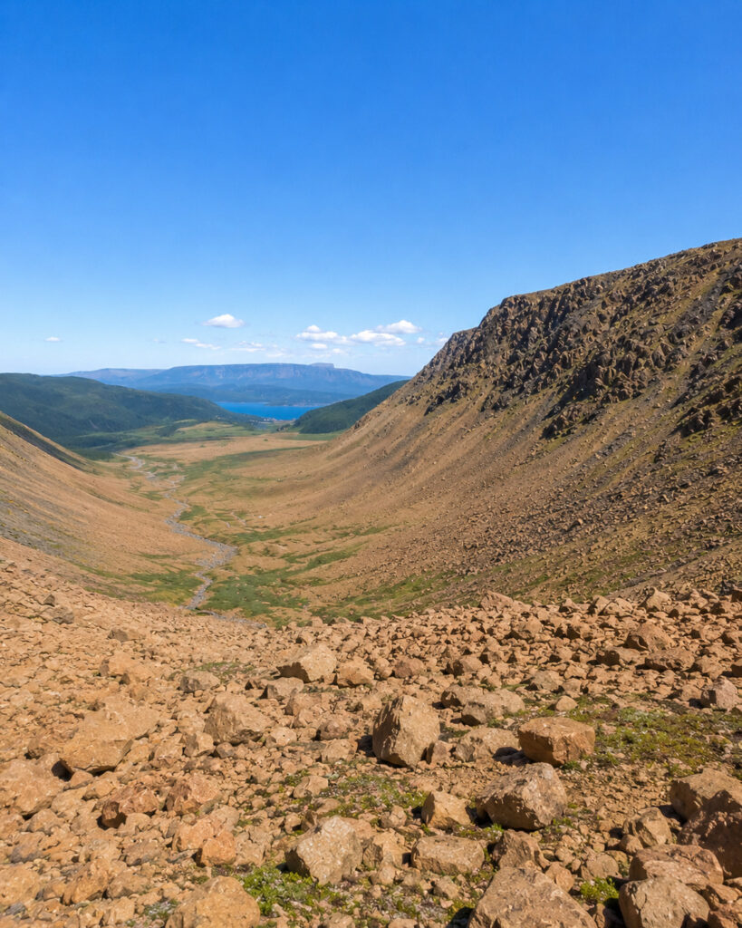
The Tablelands are the park’s most distinctive feature. They are made of peridotite, a type of rock that normally forms deep within the Earth’s mantle.
Millions of years ago, tectonic forces pushed these mantle rocks to the Earth’s surface, creating one of the few places in the world where visitors can walk on material that originally lay far beneath the planet’s crust.
The orange-brown landscape appears almost barren because the soil contains very few nutrients and high concentrations of metals. As a result, only specially adapted plants are able to survive in this harsh environment.
Western Brook Pond

Despite its name, Western Brook Pond is actually a landlocked freshwater fjord. It was originally connected to the sea, but after glaciers retreated and the land gradually rebounded, it became isolated and filled with freshwater.
Today, visitors can enjoy boat tours through the fjord, where towering cliffs rise up to 2,000 feet (600 meters) above the water. Numerous waterfalls cascade down the cliffs, creating one of the park’s most spectacular landscapes.
Gros Morne Mountain
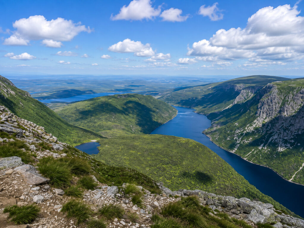
Gros Morne Mountain is the highest peak in the park, rising to about 2,644 feet (806 meters) above sea level. The summit hike is considered one of Canada’s finest day hikes, rewarding visitors with breathtaking panoramic views of fjords, forests, mountains, and the Gulf of St. Lawrence.
Wildlife
Gros Morne National Park supports a rich variety of wildlife across its forests, wetlands, mountains, and coastal habitats.
Common mammals include the moose, woodland caribou, black bear, red fox, snowshoe hare, and the elusive Canada lynx. Moose are among the animals visitors are most likely to encounter while exploring the park.
More than 200 bird species have been recorded, including the bald eagle, peregrine falcon, common loon, osprey, and great blue heron, making the park an excellent destination for birdwatching.
Climate
Gros Morne National Park has a cool maritime climate, with weather that can change quickly throughout the year.
Summer (June–August) brings mild temperatures and offers the best conditions for hiking, boating, and sightseeing, making it the busiest tourist season.
Autumn (September–October) transforms the forests with brilliant shades of red, orange, and yellow, creating spectacular scenery for photography.
Winter (November–April) brings heavy snowfall, making the park ideal for snowshoeing, cross-country skiing, and other winter activities.
Spring (May) sees melting snow feed rivers and waterfalls, while fresh greenery begins to cover the landscape.
17. Socotra Archipelago

Socotra Archipelago is one of the world’s most extraordinary island groups, located in the Arabian Sea. Often called the “Galápagos of the Indian Ocean,” it is famous for its otherworldly landscapes, unique plants, pristine beaches, limestone caves, and an exceptionally high number of species found nowhere else on Earth.
The archipelago is best known for the iconic Dragon’s Blood Tree, whose umbrella-shaped crown and red sap have become a symbol of Socotra.
Why Is It Famous?
Socotra is famous for having one of the highest levels of endemism in the world, with many of its plants and animals found nowhere else on Earth.
The islands are home to the famous Dragon’s Blood Tree, surreal landscapes, rare wildlife, pristine beaches, limestone caves, towering mountains, and rich marine ecosystems. Because of its exceptional biodiversity and unique natural heritage, the archipelago was designated a UNESCO World Heritage Site.
History
People have lived on Socotra for thousands of years. Thanks to its strategic location along ancient maritime trade routes, the islands were visited by Arab, African, Indian, and European sailors for centuries.
Socotra was especially valued for its exports of frankincense, myrrh, dragon’s blood resin, and aloe. In 2008, the archipelago was recognized as a UNESCO World Heritage Site because of its outstanding biodiversity and remarkable concentration of endemic species.
Dragon’s Blood Tree
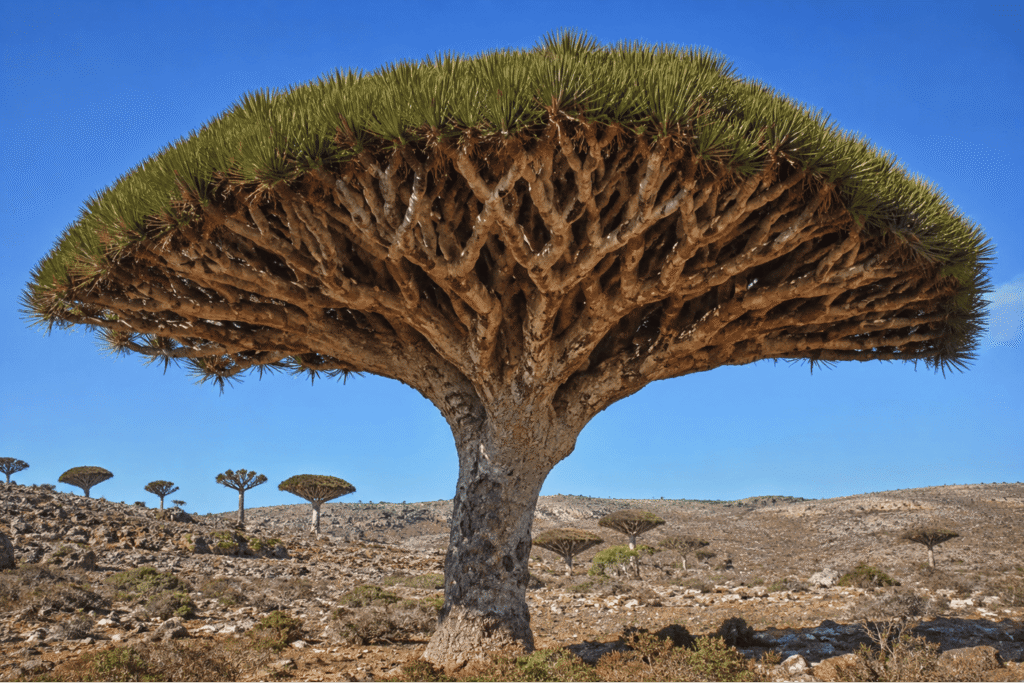
The Dragon’s Blood Tree (Dracaena cinnabari) is Socotra’s most famous and recognizable plant.
Its distinctive umbrella-shaped canopy helps reduce water loss while providing shade in the island’s hot, dry climate. When the bark is cut, it produces a dark red resin known as dragon’s blood, which has been used for centuries in traditional medicine, dyes, varnishes, and incense.
Other Unique Plants
Socotra is home to more than 800 plant species, with roughly one-third found nowhere else on Earth.
Some of the island’s most remarkable plants include the Desert Rose (Bottle Tree), whose swollen trunk stores water and produces beautiful pink flowers, the Socotra Cucumber Tree, one of the world’s few tree-form cucumbers, and the Socotra Aloe, which has long been used in traditional medicine.
Wildlife and Marine Life
Socotra supports an extraordinary variety of wildlife despite its harsh environment. There are no native large land mammals, and most mammals found on the islands today were introduced by humans.
More than 200 bird species have been recorded, including endemic species such as the Socotra sunbird, Socotra starling, Socotra bunting, and Socotra cisticola. The islands are also an important stopover for migratory birds.
Over 90% of Socotra’s reptile species are endemic, including the Socotra chameleon, numerous species of geckos, and skinks.
The surrounding waters are equally rich in biodiversity, supporting colorful coral reefs, dolphins, sea turtles, whale sharks (seasonally), rays, reef fish, and lobsters. These waters are considered some of the least disturbed marine environments in the region.
Landscape
Socotra’s landscapes are unlike almost anywhere else on Earth. The archipelago features rugged granite mountains, limestone plateaus, white-sand beaches, towering sand dunes, coastal lagoons, vast cave systems, and dry desert plains.
Some of its best-known natural attractions include the Hajhir Mountains, Hoq Cave, Arher Sand Dunes, and the beautiful Qalansiyah Beach.
Climate
Socotra has a hot desert climate, although temperatures vary with elevation.
The best time to visit is October to April, when the weather is milder, the seas are calmer, and travel conditions are ideal.
From May to September, strong monsoon winds create rough seas that can make parts of the archipelago difficult to reach. Rainfall is generally low but tends to increase at higher elevations.
18. Phong Nha–Kẻ Bàng National Park

Phong Nha–Kẻ Bàng National Park is one of Southeast Asia’s most spectacular natural treasures. Located in Quảng Bình Province in central Vietnam, the park is renowned for its dramatic limestone karst mountains, dense tropical forests, underground rivers, and one of the world’s largest and most impressive cave systems.
The park is home to Sơn Đoòng Cave, the largest known cave in the world by volume, making it a dream destination for adventurers, geologists, and nature lovers.
Why Is It Famous?
Phong Nha–Kẻ Bàng National Park is famous for containing Sơn Đoòng, the world’s largest known cave by volume. It also features more than 400 caves and cave systems, many of which are still being explored today.
The park is known for its spectacular limestone karst mountains, some of the oldest in Asia at over 400 million years old, as well as its underground rivers, giant sinkholes, tropical forests, and remarkable biodiversity. These unique natural features have made it one of the world’s premier destinations for cave exploration and adventure tourism.
History
The caves of Phong Nha–Kẻ Bàng have been known to local communities for centuries, but modern scientific exploration expanded rapidly during the 1990s.
The area was officially designated a national park in 2001 and became a UNESCO World Heritage Site in 2003 because of its outstanding geological value. UNESCO expanded the protected area in 2015 to include additional ecosystems and karst landscapes.
In 2009, a team of British cave explorers confirmed that Sơn Đoòng Cave is the largest known cave in the world by volume, bringing worldwide attention to the park.
Sơn Đoòng Cave

Sơn Đoòng Cave is the park’s most famous attraction and the largest known cave in the world by volume.
The cave stretches for more than 4 miles (6.5 kilometers) based on the currently surveyed length. In some places, it reaches over 656 feet (200 meters) in height and 492 feet (150 meters) in width, making its enormous chambers large enough to accommodate an entire city block or even a Boeing 747 aircraft.
Among its most remarkable features are underground rivers, massive stalagmites, giant cave pearls, and two enormous skylights where collapsed sections of the ceiling allow sunlight to enter. These openings have created a lush underground rainforest known as the “Garden of Edam.”
Other Famous Caves
A. Phong Nha Cave

Famous for its underground river, Phong Nha Cave is explored by boat and features impressive stalactites and stalagmites.
B. Paradise Cave (Thiên Đường Cave)
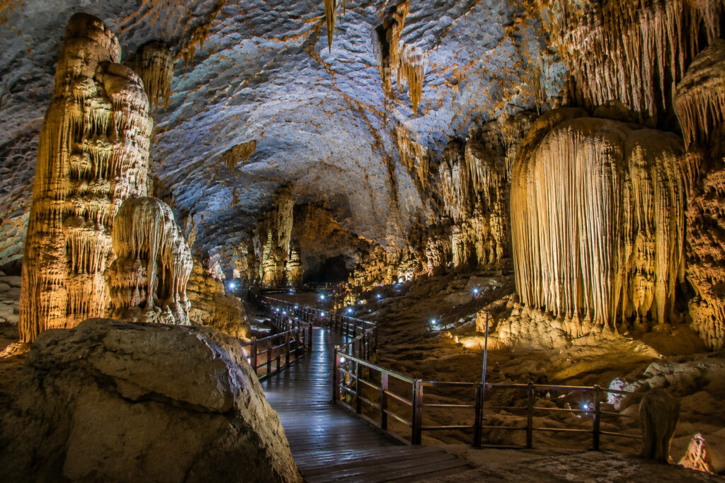
Stretching about 19 miles (31 kilometers), Paradise Cave is one of Asia’s most beautiful dry caves and is renowned for its spectacular rock formations.
C. Hang En Cave

Hang En Cave contains one of the world’s largest cave passages. It is a favorite among adventure trekkers and features a sandy beach and an underground river.
D. Dark Cave (Hang Tối)

Dark Cave is well known for its adventure activities, including ziplining, kayaking, and mud bathing.
Landscape
The park’s landscapes include towering limestone mountains, dense tropical forests, underground rivers, valleys, waterfalls, sinkholes, dramatic cliffs, and an extensive network of caves.
Its limestone karst system is among the oldest in Asia, having formed more than 400 million years ago through millions of years of geological activity and erosion.
Wildlife
Phong Nha–Kẻ Bàng National Park supports exceptional biodiversity across its forests and limestone mountains.
More than 150 mammal species have been recorded, including the red-shanked douc langur, Asian black bear, clouded leopard (rare), leopard cat, gaur, and wild pig. The surrounding region is also part of the range of the extremely rare saola, although sightings are exceptionally uncommon.
The park is also home to more than 300 bird species, including the great hornbill, crested serpent eagle, green peafowl, and numerous species of kingfishers.
Its forests and caves support a wide variety of reptiles and amphibians, including geckos, frogs, turtles, and snakes, many of which are endemic or threatened.
Climate
Phong Nha–Kẻ Bàng National Park has a tropical monsoon climate.
The dry season (February–August) brings warm temperatures and offers the best conditions for cave exploration, hiking, and outdoor activities.
During the rainy season (September–January), heavy rainfall can cause flooding, and some caves may temporarily close for safety.
Average temperatures throughout the year generally range from 68–84°F (20–29°C).
19. Bwindi Impenetrable National Park

Bwindi Impenetrable National Park is one of Africa’s most extraordinary rainforests and one of the world’s most important wildlife conservation areas. Located in southwestern Uganda, the park is best known for protecting nearly half of the world’s remaining mountain gorillas.
With its dense, ancient rainforest, rugged hills, waterfalls, and exceptional biodiversity, Bwindi is a paradise for wildlife enthusiasts, birdwatchers, and nature lovers. It is also one of the few places on Earth where visitors can experience the unforgettable adventure of mountain gorilla trekking.
Why Is It Famous?
Bwindi is famous for protecting nearly half of the world’s remaining mountain gorillas, making it one of the best places on Earth to observe these remarkable primates in the wild.
The park is also home to one of Africa’s oldest tropical rainforests and supports an extraordinary diversity of plants and animals, including hundreds of bird and butterfly species, many of which are found only in the Albertine Rift. Its combination of biodiversity, conservation success, and unforgettable gorilla trekking experiences has made Bwindi one of Africa’s most celebrated national parks.
History
Bwindi’s rainforest is estimated to be more than 25,000 years old, making it one of Africa’s oldest surviving forests.
To protect its unique ecosystems and wildlife, the area was designated a forest reserve in 1932. It officially became Bwindi Impenetrable National Park in 1991, and in 1994 it was recognized as a UNESCO World Heritage Site for its exceptional biodiversity and global conservation importance.
Today, the park is carefully managed through a combination of wildlife conservation, scientific research, and community-based tourism.
Landscape
Bwindi’s landscape is made up of dense tropical rainforest, steep mountains, deep valleys, waterfalls, rivers, bamboo zones, and mist-covered hills.
The name “Impenetrable” refers to the forest’s thick vegetation, tangled vines, and rugged terrain, which make traveling through the jungle both challenging and adventurous.
Mountain Gorillas
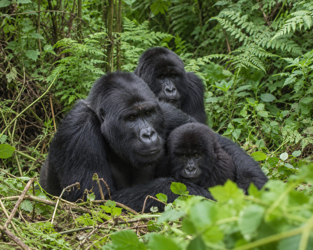
The mountain gorilla (Gorilla beringei beringei) is the park’s most famous resident.
Once critically endangered, the species has recovered significantly thanks to decades of conservation efforts, although it remains Endangered.
Mountain gorillas live in close-knit family groups led by a dominant silverback male and feed mainly on leaves, stems, shoots, and fruit.
Visitors can join guided treks to observe habituated gorilla families in their natural habitat while following strict conservation guidelines designed to protect both the gorillas and their fragile environment.
Wildlife
Bwindi Impenetrable National Park supports an extraordinary variety of wildlife.
More than 120 mammal species have been recorded, including the mountain gorilla, chimpanzee, African forest elephant, giant forest hog, L’Hoest’s monkey, black-and-white colobus monkey, and blue monkey.
The park is also one of Africa’s premier birdwatching destinations. More than 350 bird species have been recorded, with over 20 species endemic to the Albertine Rift. Notable birds include the African green broadbill, great blue turaco, Rwenzori turaco, and Shelley’s crimsonwing.
In addition, Bwindi is home to more than 300 butterfly species, making it one of the richest butterfly habitats in Africa.
Climate
Bwindi has a tropical montane climate, with cool temperatures throughout the year because of its high elevation.
The dry seasons (June–August and December–February) offer the best conditions for gorilla trekking, with more comfortable hiking trails and generally clearer weather.
During the wet seasons (March–May and September–November), heavy rainfall makes the forest lush and vibrant, although muddy trails can make trekking more challenging.
20. Los Glaciares National Park
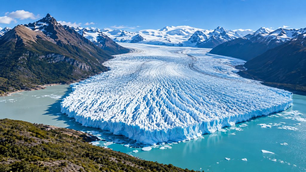
Los Glaciares National Park is one of the world’s most spectacular wilderness areas, located in Patagonia, southwestern Argentina. The park is famous for its enormous glaciers, turquoise lakes, rugged Andes mountains, and iconic peaks such as Mount Fitz Roy and Cerro Torre.
Named after its many glaciers, the park protects the largest ice-covered region in the Southern Hemisphere outside Antarctica, making it one of South America’s greatest natural treasures.
Why Is It Famous?
Los Glaciares National Park is famous for being home to the spectacular Perito Moreno Glacier, one of the few glaciers in the world that remains relatively stable despite global glacier retreat.
The park also protects 47 major glaciers and hundreds of smaller ones, forming part of the Southern Patagonian Ice Field, the third-largest reserve of freshwater ice on Earth after Antarctica and Greenland. Its dramatic granite peaks, pristine glacial lakes, and world-class hiking and climbing opportunities make it one of South America’s premier natural destinations.
History
The region has been home to Indigenous peoples, including the Tehuelche, for thousands of years.
To protect its extraordinary glaciers, mountains, and unique ecosystems, Los Glaciares National Park was established in 1937. In 1981, it was designated a UNESCO World Heritage Site in recognition of its exceptional natural beauty and outstanding glacial landscapes.
Today, it is one of Argentina’s most visited national parks and a major destination for outdoor adventure and nature tourism.
The Southern Patagonian Ice Field
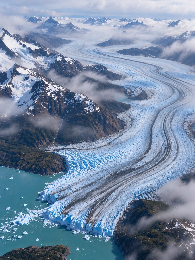
The park protects part of the vast Southern Patagonian Ice Field, the largest ice field in the Southern Hemisphere outside Antarctica.
This enormous ice mass feeds dozens of glaciers, stores an immense volume of freshwater, and continues to shape the surrounding mountains and valleys through the slow movement of ice.
Perito Moreno Glacier
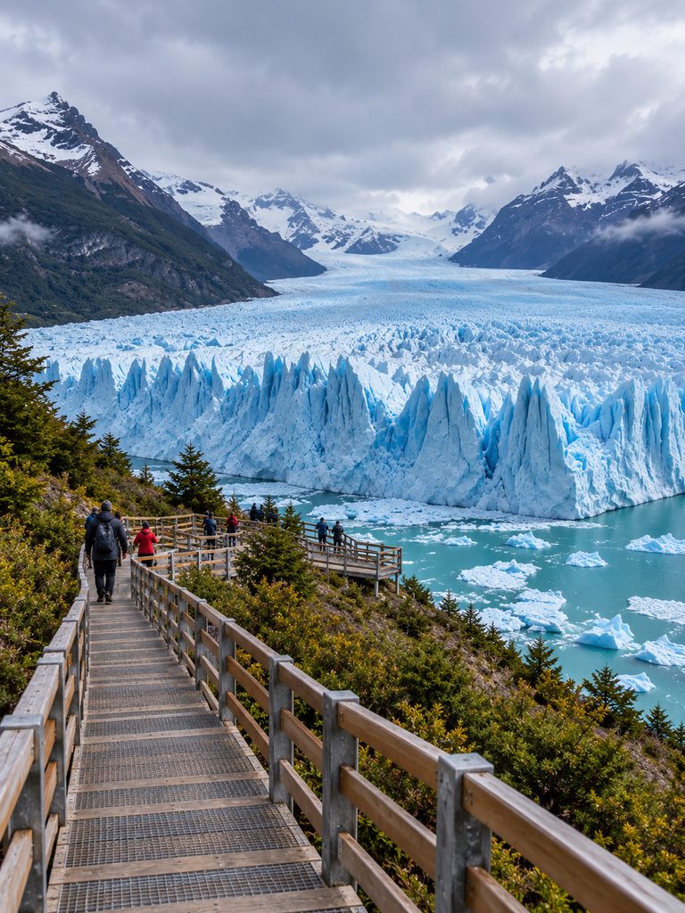
The Perito Moreno Glacier is the park’s most famous attraction. It stretches for about 19 miles (30 kilometers), with an ice wall rising up to 230 feet (70 meters) above Lake Argentino and measuring around 3 miles (5 kilometers) wide.
Unlike many glaciers around the world, Perito Moreno has remained relatively stable for decades, although it still naturally advances and retreats over time.
One of its most spectacular sights is ice calving, when enormous blocks of ice break away from the glacier and crash into the lake with a thunderous roar.
Other Major Glaciers
A. Upsala Glacier
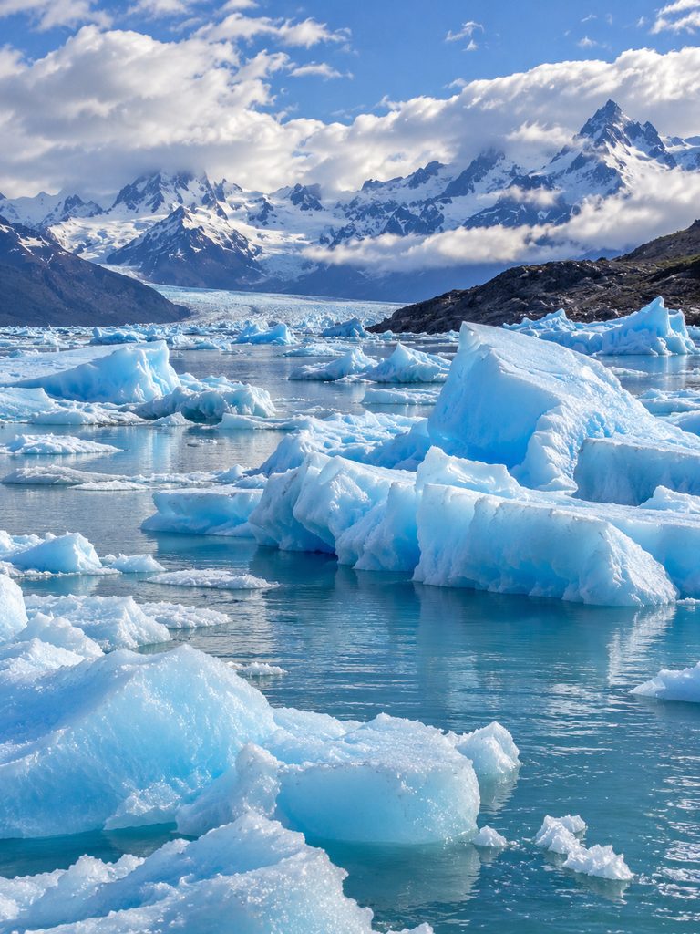
One of the park’s largest glaciers, Upsala Glacier has experienced significant retreat in recent decades because of climate change.
B. Spegazzini Glacier
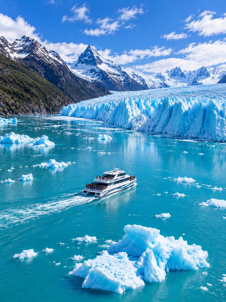
Spegazzini Glacier is famous for its towering ice walls, some of the tallest in the park.
C. Viedma Glacier
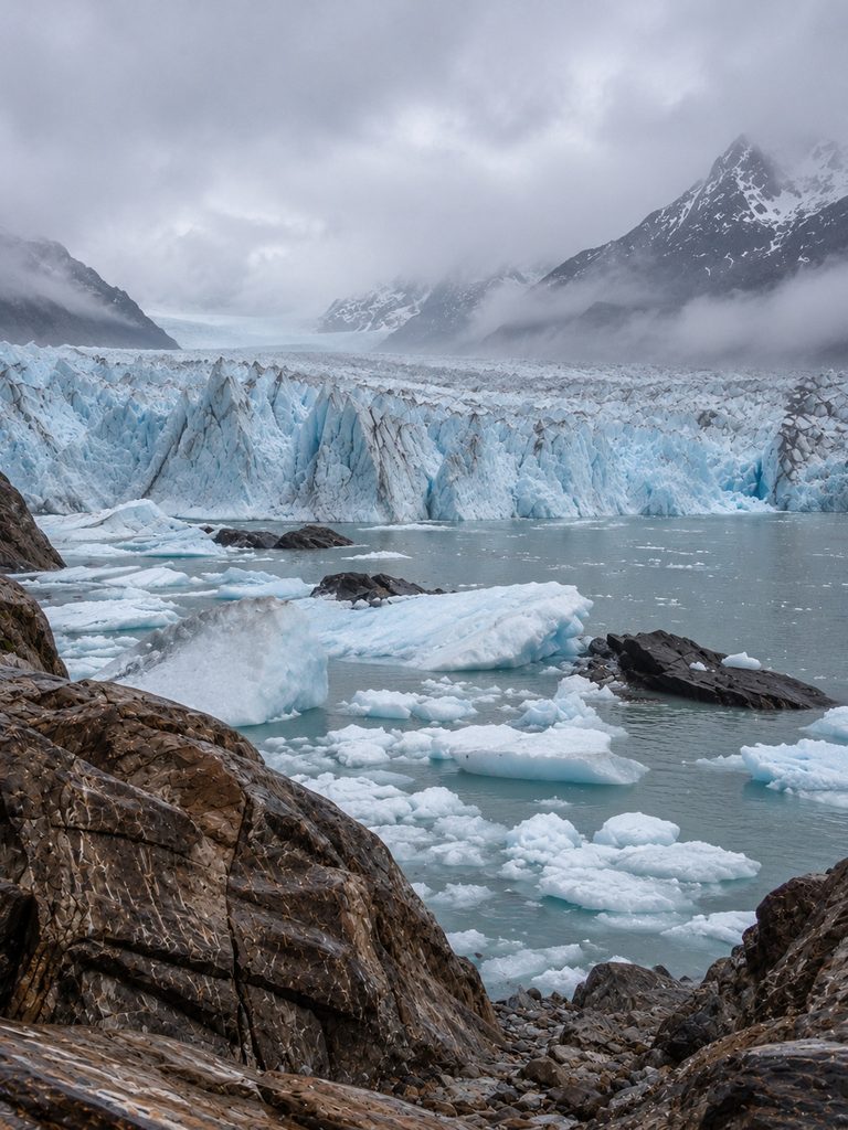
One of Argentina’s largest glaciers, Viedma Glacier is a popular destination for glacier trekking and scenic boat tours.
Mountains
A. Mount Fitz Roy
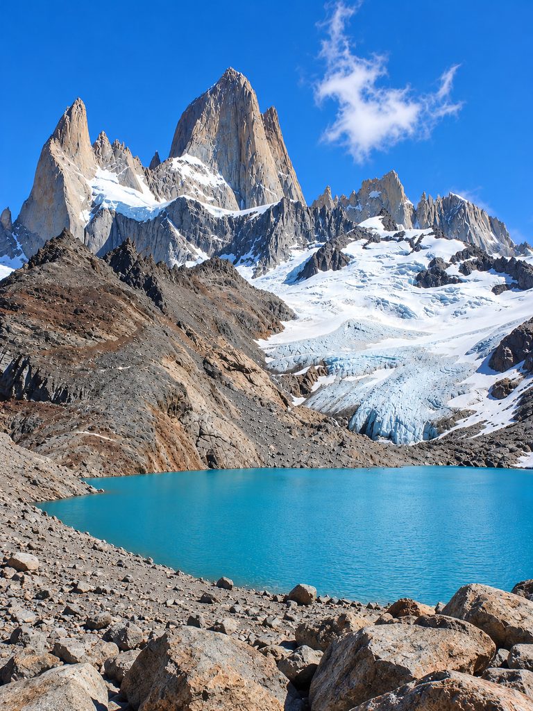
Rising to about 11,171 feet (3,405 meters), Mount Fitz Roy is one of the world’s most recognizable granite peaks and a legendary destination for experienced climbers.
B. Cerro Torre

Standing about 10,262 feet (3,128 meters) high, Cerro Torre is renowned for its steep granite spire and the dramatic weather conditions that surround it.
Lakes
A. Lake Argentino
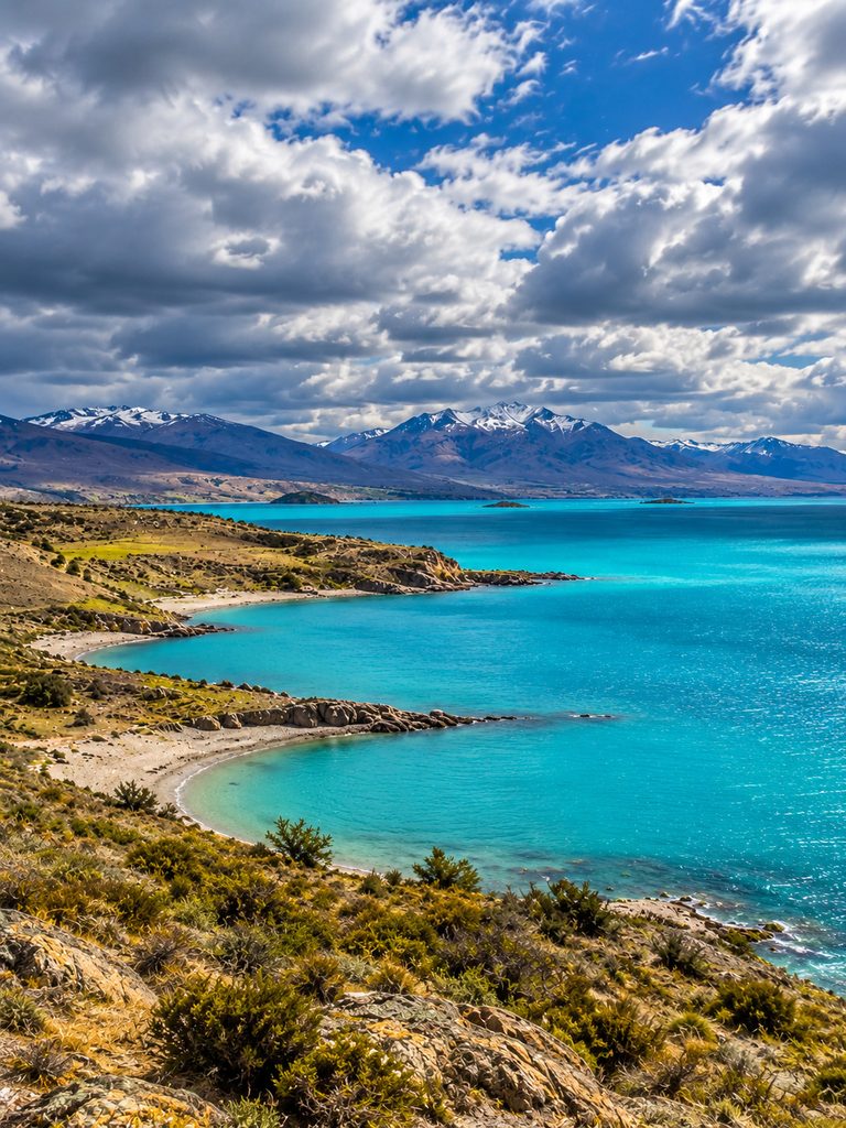
Lake Argentino is Argentina’s largest freshwater lake and is fed by numerous glaciers, including Perito Moreno Glacier.
B. Lake Viedma
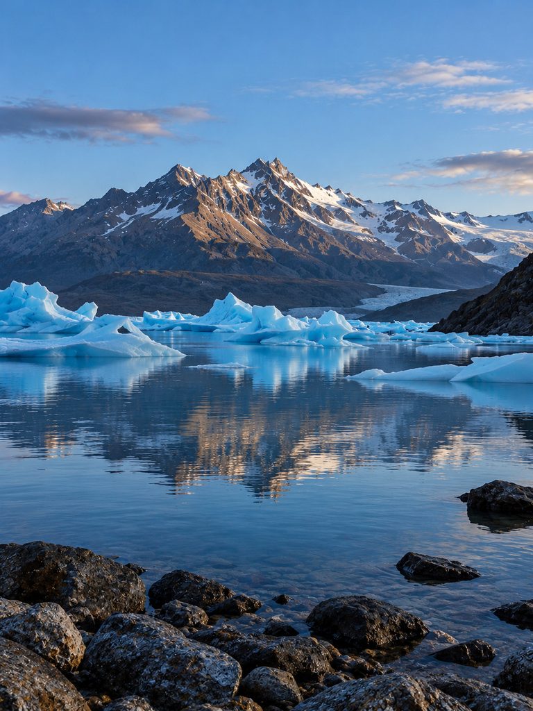
Fed by Viedma Glacier, Lake Viedma is well known for kayaking, boat cruises, and spectacular views of the surrounding mountains.
Wildlife

Los Glaciares National Park supports a diverse range of Patagonian wildlife.
Its mammals include the guanaco, huemul (South Andean deer), puma (rarely seen), Patagonian fox, and armadillo.
More than 100 bird species have been recorded, including the majestic Andean condor, black-chested buzzard-eagle, Magellanic woodpecker, and torrent duck.
Climate
Los Glaciares National Park has a cold Patagonian climate, with strong winds common throughout much of the year.
Summer (December–February) brings mild temperatures, long daylight hours, and the best conditions for hiking and sightseeing.
Autumn (March–May) offers cooler weather and beautiful forests painted in shades of red, orange, and yellow.
Winter (June–August) brings snow to the higher elevations, making many hiking trails difficult to access.
Spring (September–November) sees melting snow, blooming wildflowers, and gradually warming temperatures across the park.
21. Guilin Karst

Guilin Karst is one of the world’s most breathtaking limestone landscapes, located in the Guangxi Zhuang Autonomous Region of southern China. It is famous for its dramatic cone-shaped limestone hills, winding rivers, spectacular caves, lush countryside, and picturesque villages.
For centuries, Guilin’s scenery has inspired Chinese poets, painters, and photographers. Its landscape is so iconic that it appears on the 20-yuan Chinese banknote, featuring the famous view along the Li River.
Why Is It Famous?
Guilin Karst is famous for its thousands of dramatic limestone peaks and the scenic Li River, one of China’s most beautiful waterways.
The region is also known for its spectacular caves filled with stalactites and stalagmites, peaceful countryside, traditional villages, and world-famous river cruises. Its breathtaking scenery has inspired countless works of Chinese art and literature. Guilin’s karst landscape forms part of the UNESCO-listed South China Karst World Heritage Site.
History
People have lived in the Guilin region for thousands of years. Throughout ancient Chinese history, Guilin was celebrated for its extraordinary natural beauty, inspiring generations of poets, artists, and scholars.
The Li River also served as an important transportation and trade route, helping connect communities across southern China. Today, Guilin is one of the country’s most popular tourist destinations and is internationally recognized for its remarkable karst landscape.
The Li River

The Li River is the region’s most famous attraction.
Stretching for about 102 miles (164 kilometers), the river flows from Guilin to Wuzhou. The section between Guilin and Yangshuo is widely regarded as one of the world’s most scenic river journeys.
Along the way, visitors can admire towering limestone peaks, bamboo groves, traditional fishing villages, grazing water buffalo, and peaceful riverside scenery. River cruises and bamboo raft rides offer some of the best ways to experience this spectacular landscape.
Yangshuo

Yangshuo is one of China’s most popular scenic destinations and is surrounded by some of the country’s most beautiful karst landscapes. The area is famous for cycling through rice fields, bamboo rafting on the Yulong River, traditional villages, rock climbing, and breathtaking mountain views.
Famous Caves
A. Reed Flute Cave

About 790 feet (240 meters) long, Reed Flute Cave is famous for its colorful illuminated limestone formations, spectacular stalactites, stalagmites, and large underground chambers.
B. Silver Cave

Silver Cave is one of the largest cave systems near Yangshuo and is renowned for its sparkling calcite formations.
C. Seven Star Cave

Located within Seven Star Park, Seven Star Cave is one of Guilin’s oldest and most popular tourist attractions.
Landscape

Guilin’s landscape is made up of towering limestone formations, cone-shaped hills, winding rivers, rice fields, bamboo forests, caves, valleys, and tranquil lakes.
The striking contrast between emerald-green mountains and winding waterways creates one of the most recognizable and photogenic landscapes in China.
Wildlife
The Guilin region supports a rich variety of wildlife across its forests, rivers, and wetlands.
Common mammals include the rhesus macaque, civets, wild boar, and several species of small deer.
More than 300 bird species have been recorded, including kingfishers, egrets, herons, bulbuls, and owls, making the region a rewarding destination for birdwatchers.
Its rivers and forests also provide habitat for numerous amphibians and reptiles, including frogs, geckos, freshwater turtles, and salamanders. Parts of the broader region also support habitat suitable for the critically endangered Chinese giant salamander.
Climate
Guilin has a humid subtropical climate, with warm temperatures and abundant rainfall throughout much of the year.
Spring (March–May) brings pleasant temperatures, frequent rain, and mist-covered mountains that create some of the region’s most iconic scenery.
Summer (June–August) is hot and humid, with lush green landscapes and vibrant vegetation.
Autumn (September–November) offers comfortable weather, clear skies, and excellent conditions for sightseeing and photography.
Winter (December–February) is generally cool but mild, with fewer tourists and a more peaceful atmosphere.
22. Wulingyuan Scenic and Historic Interest Area

Wulingyuan Scenic and Historic Interest Area is one of China’s most spectacular natural landscapes, located in Hunan Province in central China. It is famous for its thousands of towering sandstone pillars, deep ravines, mist-covered mountains, caves, waterfalls, and lush subtropical forests.
The landscape is so unusual that it is often described as a “floating mountain world.” Its towering rock formations also became internationally famous after being associated with the floating mountains in the movie Avatar.
Wulingyuan was designated a UNESCO World Heritage Site in 1992 because of its extraordinary natural beauty and unique geological formations.
Why Is It Famous?
Wulingyuan is famous for its more than 3,000 sandstone pillars and peaks, deep valleys and ravines, mist-covered mountains, dense subtropical forests, hundreds of caves, numerous waterfalls and streams, spectacular viewpoints and hiking trails, and its association with the landscapes of Avatar.
History
The Wulingyuan region has been inhabited by local communities for centuries.
The area became increasingly recognized for its natural beauty during the 20th century. Important milestones include 1982, when Zhangjiajie National Forest Park was established; 1992, when Wulingyuan was designated a UNESCO World Heritage Site; and 2004, when Wulingyuan became part of the UNESCO Global Geoparks Network.
How Was Wulingyuan Formed?
The landscape was formed over hundreds of millions of years. Its distinctive pillars are primarily made of quartz sandstone. The formation process began when thick layers of sandstone were deposited and later uplifted by tectonic forces.
Rivers and rainwater gradually eroded the rock, while weathering widened cracks and fractures. Over millions of years, this erosion left behind the narrow vertical pillars we see today. The result is a spectacular landscape of isolated rock towers separated by deep valleys.
Zhangjiajie National Forest Park
Zhangjiajie National Forest Park is probably the most famous part of Wulingyuan. It contains some of the region’s most spectacular formations.
A. Yuanjiajie

One of the most popular areas, Yuanjiajie is known for its massive sandstone pillars, mountain viewpoints, and the famous Southern Sky Column, which is popularly known as Avatar Hallelujah Mountain.
B. Bailong Elevator

The Bailong Elevator is a huge outdoor glass elevator built into a cliff. It rises approximately 326 meters (1,070 feet) and provides access to the upper mountain areas while offering impressive views of the surrounding landscape.
Avatar Hallelujah Mountain
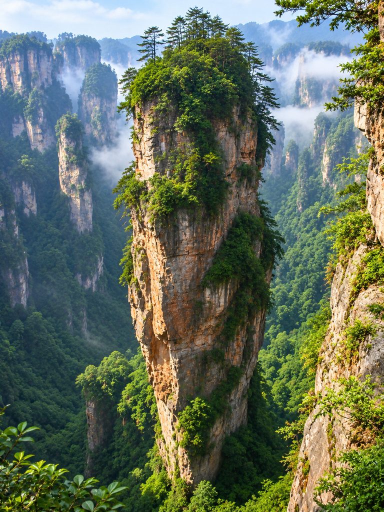
One of the area’s most photographed formations is the Southern Sky Column, located in Yuanjiajie. It became popularly known as “Avatar Hallelujah Mountain” because its appearance reminded visitors of the floating mountains in James Cameron’s Avatar. This connection helped make Zhangjiajie internationally famous.
However, the film’s fictional floating mountains were created digitally. The real landscape served as visual inspiration rather than being directly filmed as the fictional world.
Tianzi Mountain
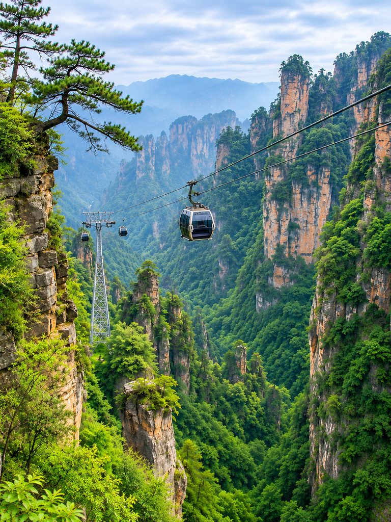
Tianzi Mountain is one of Wulingyuan’s most scenic areas. It is famous for its hundreds of towering peaks, sea-of-clouds views, sunrises and sunsets, dramatic cliffs, and seasonal mist. At sunrise, clouds often fill the valleys while the sandstone pillars rise above them, creating one of the region’s most iconic views.
Suoxiyu Nature Reserve
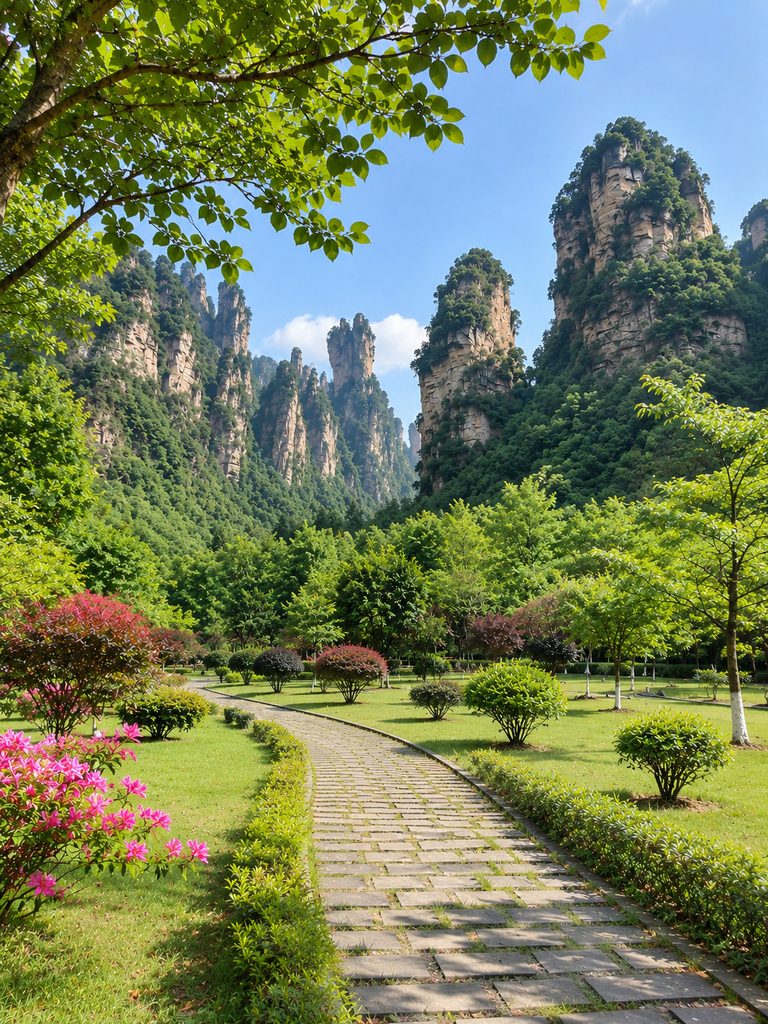
Suoxiyu is another major section of the World Heritage area. It contains Baofeng Lake, waterfalls, caves, forests, narrow valleys, and numerous sandstone peaks. Baofeng Lake is particularly popular for scenic boat trips surrounded by steep mountains.
Caves and Waterfalls
The area contains hundreds of caves.
A. Huanglong Cave

One of the best-known caves near Wulingyuan, Huanglong Cave features huge chambers, underground rivers, stalactites, stalagmites, and dramatic limestone formations. The region also contains numerous waterfalls, which become especially impressive during the rainy season.
Wildlife
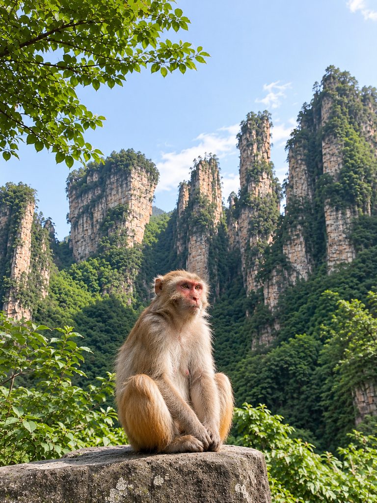
Wulingyuan’s forests provide habitat for a wide range of wildlife. Species found in the wider region include rhesus macaques, Chinese muntjac, wild boar, masked palm civets, and various small mammals. Some larger and rarer species are difficult to spot because of the dense forest and rugged terrain.
The forests also support numerous bird species, including various pheasants, owls, woodpeckers, drongos, and kingfishers.
Climate
Wulingyuan has a humid subtropical climate.
In spring (March–May), the weather is mild and humid, with frequent mist and rain, and the forests become lush and green.
In summer (June–August), it is warm and humid with frequent rainfall, making the waterfalls particularly impressive.
In autumn (September–November), the weather is cooler and generally comfortable for hiking, with beautiful foliage.
In winter (December–February), it can be cold and occasionally snowy at higher elevations, with fewer visitors and spectacular frost and snow-covered scenery.
23. Sundarbans National Park
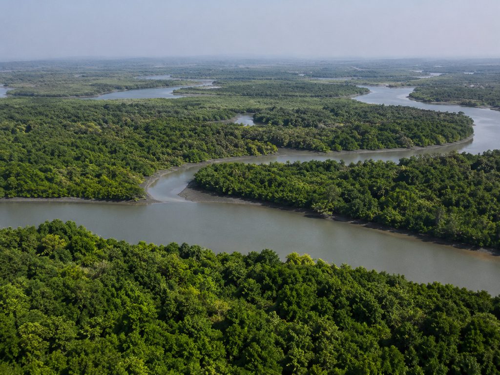
Sundarbans National Park is one of the most unique mangrove and wetland ecosystems in the world. It is located in West Bengal, India, and is part of the huge Sundarbans mangrove forest, which stretches across the delta of the Ganges, Brahmaputra, and Meghna rivers in India and Bangladesh.
The park is best known for its Royal Bengal tigers, which have adapted to life in the tidal waterways, muddy islands, and dense mangrove forests. Sundarbans National Park is also a UNESCO World Heritage Site and a Tiger Reserve, and it provides an important home for many threatened animals and wetland species.
Why Is It Famous?
Sundarbans National Park is famous for its huge mangrove forests and its Royal Bengal tigers. The park is filled with tidal rivers, narrow creeks, muddy islands, and small channels that make the landscape very different from most other national parks in India.
It is also home to many animals and plants that have adapted to the salty and waterlogged environment. The mangrove forests also help protect nearby coastal communities from storms, cyclones, and flooding.
History
People have lived around the Sundarbans for centuries and have depended on the forest for fishing, honey collection, farming, and other livelihoods. The region became an important area for wildlife conservation over time.
In 1973, the Sundarbans became part of Project Tiger. It was declared a wildlife sanctuary in 1977, became a national park in 1984, and was recognized as a UNESCO World Heritage Site in 1987. The Indian Sundarbans are also recognized as a Ramsar Wetland of International Importance.
The Royal Bengal Tiger
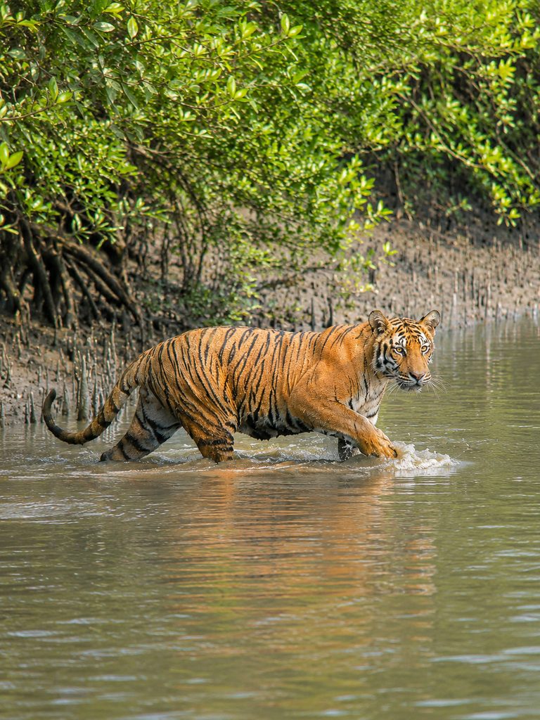
The Royal Bengal tiger is the most famous animal in Sundarbans National Park. What makes these tigers special is the way they have adapted to the unusual mangrove environment. They can swim across tidal channels, move through muddy islands, hunt in dense vegetation, and tolerate the area’s relatively salty conditions.
Seeing a tiger here can be difficult. Unlike tigers in open grasslands, Sundarbans tigers can easily disappear into the thick mangroves and dense vegetation.
Wildlife & Marine Life
Sundarbans National Park is home to a wide variety of wildlife, including mammals, reptiles, birds, and aquatic animals.
The mammals found here include the Royal Bengal tiger, spotted deer, wild boar, rhesus macaque, fishing cat, smooth-coated otter, and jungle cat.
The park’s reptiles include saltwater crocodiles, Indian pythons, king cobras, water monitors, and olive ridley sea turtles.
Its waterways are also home to aquatic animals such as Gangetic river dolphins, Irrawaddy dolphins, estuarine fish, mudskippers, and many species of crabs and shrimp.
The Sundarbans is also an important home for both resident and migratory birds. Some of the birds found here include white-bellied sea eagles, ospreys, kingfishers, herons, egrets, cormorants, Brahminy kites, and lesser adjutants. The wetlands provide important feeding and nesting areas for many of these birds.
Mangrove Forest

The name Sundarbans is commonly linked to the Sundari tree (Heritiera fomes), one of the region’s characteristic mangrove trees. Other mangrove plants found here include Avicennia, Rhizophora, Bruguiera, Sonneratia, and Nypa palms.
These plants have special adaptations that help them survive in difficult conditions, including saltwater, waterlogged soil, regular tidal flooding, and low-oxygen mud. This is what makes the Sundarbans such a fascinating ecosystem.
The Unique Roots
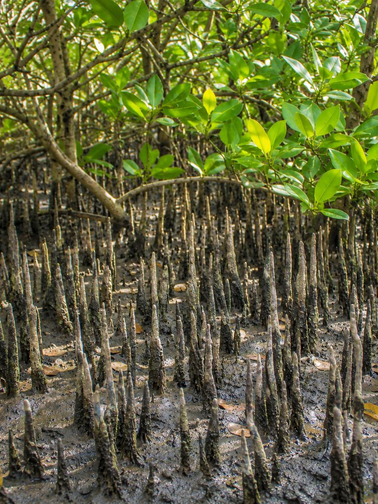
One of the most interesting things about mangrove forests is their unusual root systems. Some mangrove trees grow pneumatophores, which are vertical roots that stick out of the mud and help the plant take in oxygen.
Other mangrove trees have prop roots, stilt roots, or buttress roots. These special roots help the trees stay stable and survive in soft, muddy ground where ordinary trees would have difficulty growing.
Tidal Rivers and Creeks
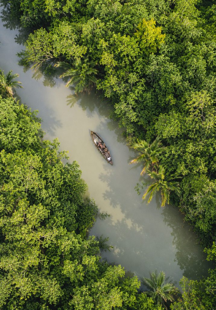
Unlike many other national parks in India, the Sundarbans is mainly explored by boat. The park has a huge network of rivers, creeks, tidal channels, mudflats, and islands.
The scenery can change throughout the day as the tides move water in and out of the forest. At one time, an area may be covered with water, while a few hours later, parts of the muddy land may appear again.
Climate
The Sundarbans has a tropical monsoon climate. From November to February, winter is cooler, drier, and generally more comfortable for visitors. From March to May, the weather becomes hot and humid, with temperatures rising as summer approaches.
The monsoon season, from June to September, brings heavy rainfall, high humidity, and strong tidal activity. The region can also be affected by cyclones, especially during the pre- and post-monsoon periods.
24. Everglades National Park
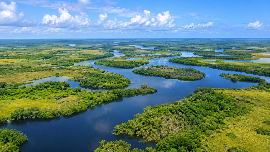
Everglades National Park is one of the most extraordinary wetland ecosystems in the world. Located in southern Florida, USA, it protects a huge mix of wetlands, sawgrass marshes, mangrove forests, freshwater sloughs, coastal lagoons, and pine forests.
Often called the “River of Grass,” the Everglades is not actually a river. It is a huge, shallow sheet of freshwater that slowly moves south across the landscape. The park is especially famous for its American alligators, American crocodiles, manatees, and incredible variety of birds.
It is also a UNESCO World Heritage Site, an International Biosphere Reserve, and a Ramsar Wetland of International Importance.
Why Is It Famous?
Everglades National Park is famous for protecting one of the largest tropical wetland ecosystems in North America. It contains one of the largest protected mangrove ecosystems in the Northern Hemisphere and is home to both American alligators and American crocodiles.
The park also provides important habitat for endangered species such as the Florida panther and supports hundreds of bird species. Its landscape includes freshwater marshes, mangrove forests, pine rocklands, and coastal ecosystems, making it one of the world’s most important wetland conservation areas.
History
Long before the national park was created, Indigenous peoples lived throughout South Florida. Two important Indigenous groups connected to the Everglades are the Miccosukee and Seminole.
People depended on the wetlands for food, transportation, shelter, and other resources. One of the biggest conservation milestones came in 1947, when Everglades National Park was established. In 1979, it was added to the UNESCO World Heritage List and also became an International Biosphere Reserve. In 1987, it was recognized as a Wetland of International Importance under the Ramsar Convention.
What Exactly Is the Everglades?
The Everglades is often described as a huge swamp, but it is actually a complex wetland ecosystem made up of sawgrass marshes, freshwater sloughs, mangrove forests, coastal lagoons, hardwood hammocks, pine rocklands, cypress forests, and estuaries.
Historically, water from the Lake Okeechobee region slowly moved south through the Everglades toward Florida Bay. This slow-moving sheet of water is the reason the Everglades became known as the “River of Grass.”
Sawgrass Marshes

Sawgrass is one of the most recognizable plants in the Everglades. Its sharp-edged leaves can grow several feet tall and cover huge areas of the wetlands.
These marshes provide shelter for wildlife, nesting areas for birds, and important habitat for many species. Although it looks like ordinary grass, sawgrass is actually a type of sedge.
American Alligator
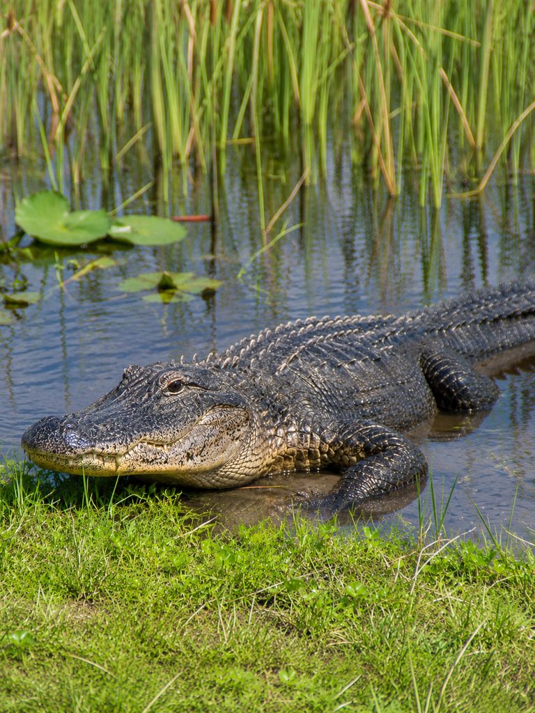
The American alligator is probably the most recognizable animal in the Everglades.
Alligators play an important role in the ecosystem. They create “alligator holes” by digging small depressions in the marsh. During dry periods, these holes can hold water and provide refuge for fish, turtles, birds, and other wildlife. Because of this, alligators are considered important ecosystem engineers.
American Crocodile

The Everglades is one of the few places in the United States where the American crocodile naturally occurs. Unlike alligators, crocodiles are more comfortable in brackish and saltwater environments, including coastal wetlands and mangrove estuaries.
Southern Florida is near the northern edge of the American crocodile’s natural range, making the Everglades an important habitat for this species.
Wildlife
The park supports an incredible variety of wildlife, including mammals, birds, reptiles, amphibians, and aquatic species.
Mammals found in the Everglades include the West Indian manatee, Florida panther, raccoon, marsh rabbit, river otter, white-tailed deer, and bobcat. The Florida panther is especially important because it is one of the most endangered mammals in the United States.
The Everglades is also one of North America’s most important bird habitats. More than 360 bird species have been recorded in the park and surrounding ecosystem. Some notable species include the great egret, great blue heron, roseate spoonbill, wood stork, anhinga, osprey, white ibis, and brown pelican. Many migratory birds also visit the region during different times of the year.
The park is home to many reptiles and amphibians, including American alligators, American crocodiles, green anoles, Florida softshell turtles, snakes, frogs, and other turtles. The ecosystem also faces a major threat from invasive Burmese pythons, which have established a large population in South Florida.
Mangrove Forests

Mangroves cover many of the coastal areas of the park. The three main mangrove species found here are red mangrove, black mangrove, and white mangrove.
These trees are extremely important to the coastal ecosystem. They help stabilize shorelines, reduce erosion, provide nursery areas for fish, protect coastal habitats, and store large amounts of carbon.
Florida Bay

Florida Bay lies along the southern edge of the Everglades. It is a shallow coastal lagoon filled with mangrove islands, seagrass beds, and estuarine habitats.
The bay is an important home and feeding area for fish, sea turtles, dolphins, manatees, and many species of birds. Its health is closely connected to the health of the wider Everglades ecosystem.
Invasive Species

One of the biggest modern challenges facing the Everglades is invasive species.
Burmese pythons were introduced to South Florida and have since established a breeding population. They prey on many native animals, including rabbits, raccoons, opossums, wading birds, and other mammals. Their spread has become a major conservation problem because they can put additional pressure on native wildlife.
Other invasive species found in the region include Brazilian pepper, melaleuca, and several non-native fish species. Controlling these species is an ongoing challenge for conservationists.
Climate
Everglades National Park has a tropical climate with a distinct dry and wet season.
The dry season, from November to April, usually brings lower humidity, less rainfall, and more comfortable temperatures. It is also a popular time for wildlife viewing.
The wet season, from May to October, is hot and humid, with frequent thunderstorms, higher mosquito activity, and rising water levels. The landscape can look very different during this season as rain fills the marshes and waterways.
25. Jiuzhaigou Valley Scenic and Historic Interest Area

Jiuzhaigou Valley Scenic and Historic Interest Area is one of China’s most spectacular natural landscapes. Located in northern Sichuan Province, it is famous for its bright turquoise and blue lakes, cascading waterfalls, snow-covered mountains, dense forests, and crystal-clear streams.
The name Jiuzhaigou means “Valley of Nine Villages,” referring to the nine Tibetan villages that were historically located in the valley. It is a UNESCO World Heritage Site, recognized for its incredible natural beauty, unique geological features, and rich biodiversity.
Why Is Jiuzhaigou Famous?
Jiuzhaigou is famous for its beautiful combination of turquoise and emerald-colored lakes, multi-tiered waterfalls, snow-covered mountains, ancient forests, limestone formations, crystal-clear streams, and Tibetan culture. The scenery changes dramatically with the seasons, which makes Jiuzhaigou one of China’s most beautiful and photographed natural destinations.
History
The valley has been home to Tibetan communities for centuries. The nine traditional Tibetan villages gave the valley its name. Interest in the area’s natural beauty grew during the 1970s, when scientists and visitors began paying more attention to the region.
In 1982, Jiuzhaigou became a national scenic area. In 1992, it was added to the UNESCO World Heritage List, and in 1997, it became a UNESCO Biosphere Reserve.
The Famous Lakes
Jiuzhaigou has more than 100 lakes, and each one has its own colors and scenery. Their bright colors are one of the main reasons people visit the valley.
A. Five Flower Lake

Five Flower Lake is perhaps the most famous lake in Jiuzhaigou. It is known for its beautiful mix of turquoise, deep blue, green, yellow, and pale cyan colors.
The colors come from a combination of water depth, dissolved minerals, algae, sunlight, and underwater vegetation. Fallen tree trunks can also be seen beneath the exceptionally clear water, adding to the lake’s unique appearance.
B. Mirror Lake

Mirror Lake is known for its incredibly calm surface. On a windless day, the surrounding mountains and forests can be reflected almost perfectly in the water, creating a mirror-like scene. Early morning is often one of the best times to see this effect.
C. Panda Lake

Panda Lake gets its name from the giant pandas that live in the wider region. The lake is surrounded by deep blue water, green forests, rocky landscapes, and snow during colder months.
D. Long Lake

Long Lake is one of the largest and highest lakes in Jiuzhaigou. It sits beneath snow-covered mountains and looks especially impressive during autumn and winter.
Waterfalls
Jiuzhaigou’s waterfalls are another major attraction. Many of them flow through forests and over colorful rock formations.
A. Nuorilang Waterfall
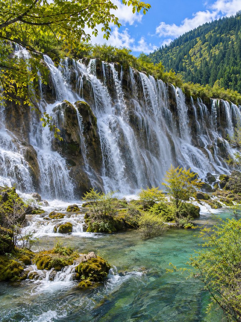
Nuorilang Waterfall is one of the most famous waterfalls in the valley. It is a wide, multi-tiered waterfall surrounded by dense forest and is one of the most recognizable sights in Jiuzhaigou.
B. Pearl Shoal Waterfall
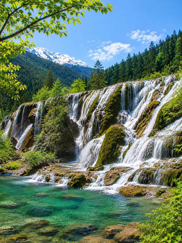
Pearl Shoal Waterfall is known for water rushing over a wide, travertine-covered formation. The flowing water creates many small cascades across the rocky surface.
C. Shuzheng Waterfall

Shuzheng Waterfall is located among the famous Shuzheng Lakes. The water flows through a series of beautiful cascades surrounded by forests and mountains.
Shuzheng Valley

Shuzheng Valley is one of Jiuzhaigou’s three main scenic valleys. It contains numerous lakes, waterfalls, forests, and Tibetan cultural sites.
The valley is especially beautiful during autumn when the surrounding forests turn shades of yellow, orange, and red, creating colorful reflections in the lakes.
Rize Valley

The Rize Valley contains some of Jiuzhaigou’s most famous sights. Its main highlights include Five Flower Lake, Panda Lake, Pearl Shoal, and Virgin Forest.
As you travel through the valley, the landscape gradually rises toward higher mountain areas, with forests, lakes, waterfalls, and snow-covered peaks along the way.
Zechawa Valley

Zechawa Valley is the highest and longest of Jiuzhaigou’s three main valleys. Its major attractions include Long Lake and Seasonal Lake.
Because of its higher elevation, snow can remain on the surrounding mountains for much of the year, giving the valley a completely different appearance during the colder months.
Forests
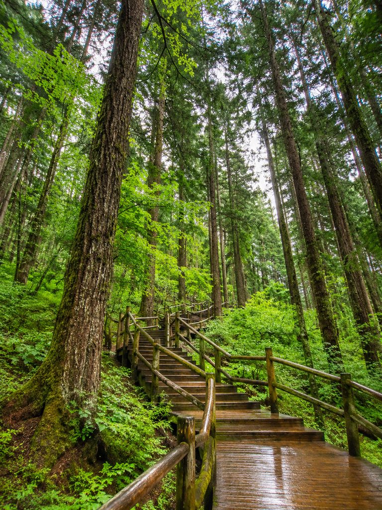
Forests cover a large part of the Jiuzhaigou landscape. The vegetation changes with altitude and includes coniferous forests, broadleaf forests, birch, fir, spruce, rhododendrons, and alpine plants.
Autumn is one of the best times to see the forests because the leaves turn brilliant shades of red, yellow, and orange, creating colorful views around the lakes and mountains.
Wildlife
Jiuzhaigou lies within the important biodiversity region of the Min Mountains. Wildlife in the wider region includes mammals such as the giant panda, Sichuan golden snub-nosed monkey, takin, Chinese serow, musk deer, and wild boar.
Many of these animals are difficult to spot because they live in dense forests and rugged mountain areas. The region also supports many bird species, including pheasants, woodpeckers, eagles, owls, and songbirds.
Tibetan Culture

Jiuzhaigou is not only a natural attraction. Tibetan communities have lived in the valley for generations, and their culture remains an important part of the area.
Visitors can see Tibetan villages, Buddhist temples, prayer flags, traditional buildings, and other cultural practices. The strong connection between local communities and the surrounding mountains, forests, and water is an important part of Jiuzhaigou’s identity.
Climate
Jiuzhaigou has a high-altitude mountain climate, with noticeable changes throughout the year.
In spring, from March to May, the weather is cool, snow begins to melt, and fresh vegetation starts appearing.
In summer, from June to August, days are generally mild to warm, rainfall is more common, and water levels in the lakes and waterfalls are usually high.
Autumn, from September to November, is one of the most spectacular times to visit. The weather is often clearer, and the forests turn brilliant shades of red, yellow, and orange.
In winter, from December to February, temperatures drop, the mountains become covered in snow, and some waterfalls and lakes may freeze. The valley is also much quieter, with fewer visitors.
Final Thoughts
UNESCO Natural World Heritage Sites represent some of the most spectacular landscapes and diverse ecosystems on our planet. From the vibrant Great Barrier Reef of Australia and the towering Himalayas of Nepal to the wildlife-rich plains of Tanzania, each destination offers a unique glimpse into the natural wonders of our world.
These remarkable places are not only incredible destinations for travelers but also vital habitats that deserve protection. Visiting responsibly, supporting conservation efforts, and respecting local ecosystems can help ensure that these treasures remain preserved for future generations.
Whether you’re planning your next adventure, creating your travel bucket list, or simply searching for inspiration, these 25 Natural UNESCO World Heritage Sites are truly worth discovering.